Viejas Mountain - Peak #13
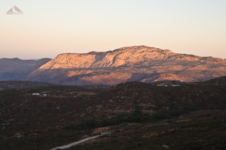
The dawn sunshine on El Cajon Mountain from Viejas Mountain
Viejas Mountain
Elevation: 4,189′
Total Mileage: ~3.5
Date Hiked: 09/17/2009
Trailhead
Peakbagger Page
For those interested, here is a list of my gear that I have found works well for me. This is, of course, an affiliate link and your enjoyment of these may vary:
09/17/2009
I got up before dawn to drive out to Alpine to get an early start. It was nice to actually start hiking up a trail with the temperature in the 80's, as opposed to being in the 90's.
I got about .75 miles up the mountain when I turned around and was treated to a great view of El Cajon Mountain washed in golden light as the sun rose over the other side of Viejas Mountain.
As I hiked up the steep rocky trail. I began to see tracks in the dirt. I thought that it was a dog print, but I realized that it would have been a pretty big dog.
After watching the tracks follow the trail for a mile or so, they disappeared. Either the dog's owner turned around, or it was from a mountain lion. It just seemed too big for a dog. [Now that I know my tracks better, it was definitely a mountain lion.- added July 2011]
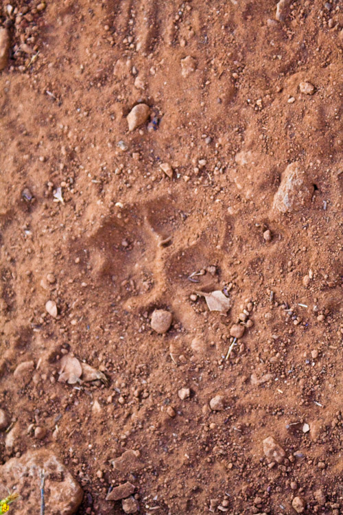
Mountain Lion Track
As I followed the trail around the northern edge of the mountain, I was presented with a great view of the rolling San Diego backcountry all the way to Eagle Peak and Cuyamaca.

The San Diego Backcountry
Once again, I was completely alone on the trail. I finally felt the rays of the sun on me as I scaled the ridge line.
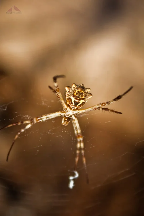
I began noticing some large spiders just off the trail. Once I got back home, I did some research and found out that it is called a Silver Garden Spider.

Silver Garden Spider
I followed the ridge and made the peak. I could see the Viejas Casino below me and the rock windbreak on the summit. There was an extraordinary amount of flies among the rocks. I searched around for a reason, but could not see anything. I saw several lizards scurrying among the rocks, taking advantage of the abundance of flies.

Lizard among the rocks

Rock pile on Viejas Mountain Summit
I descended back into the shade and had to take it easy on the way down. There were too many rocks on the very steep trail for any type of running.
I made my way back home in time for breakfast. The trail gains and loses about 1000' per mile, which, in my opinion, is pretty steep.
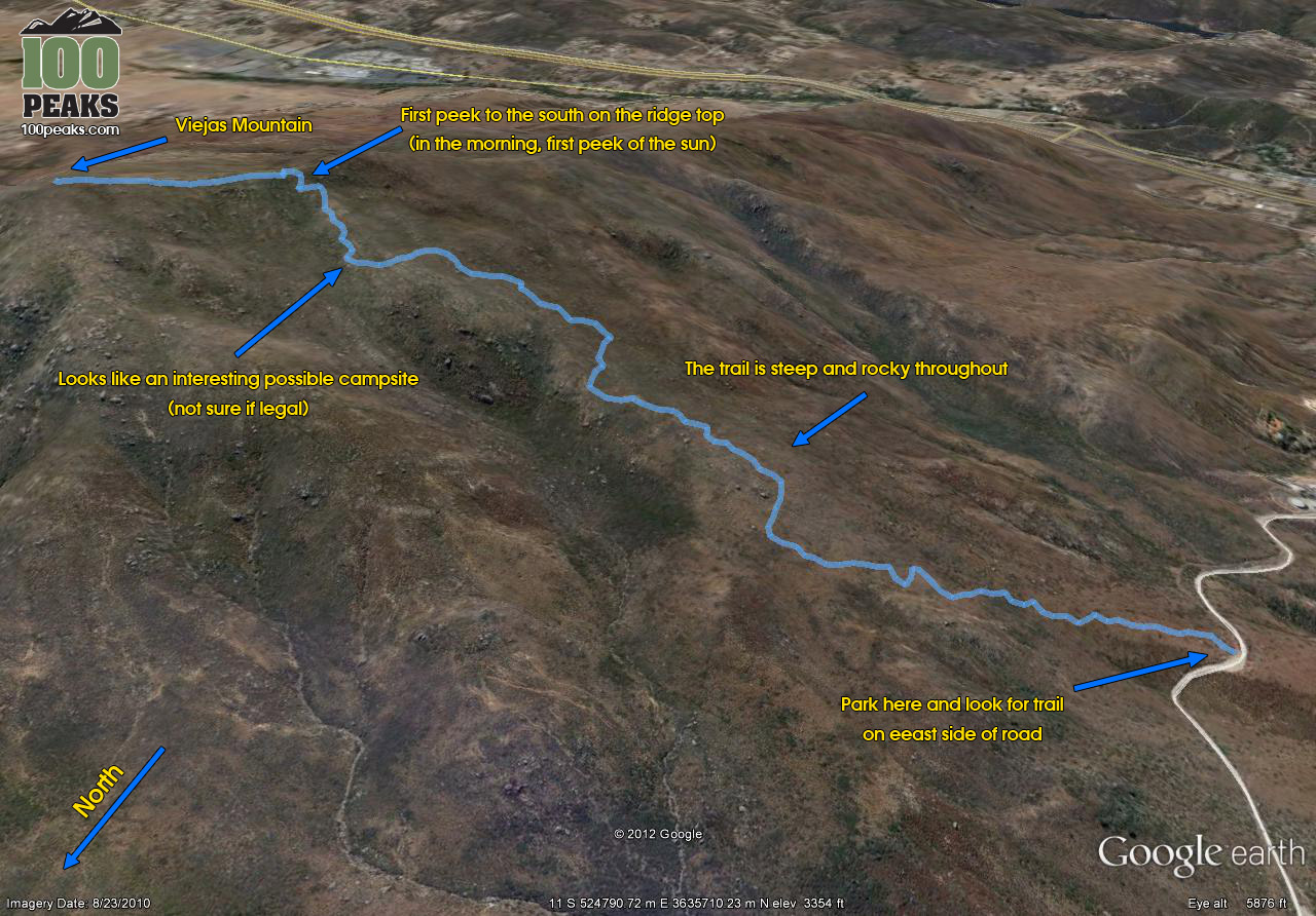
Viejas Mountain Trail Map (Click to Enlarge)