


Bonny, White, The Thimble, and Ysidro - Peaks 58 and 59 - What a difference weather makes
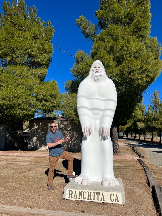
Visiting the Yeti at the Montezuma Valley Market in Ranchita
When you’re in the area, I highly recommend a visit before or after the hike at the Ranchita Bodega (Formerly Montezuma Valley Market) for cold beer and drinks, as well as snacks, local honey, camping food, and hiking and camping gear. They have a place to sit down and enjoy the fresh high-desert air. It’s only a 2-minute drive from the trailhead.
They are in the process of rebuilding their store that burnt down in April 2021. They are creating efforts to support the community of Ranchita, as well as hosting events, and providing support for Pacific Crest Trail backpackers.
Bonny Benchmark
Elevation: 4,574'
Dates Hiked: 02/25/2011, 04/10/2011
Peakbagger.com Page
White Benchmark
Elevation: 5,326′
Dates Hiked: 02/25/2011, 04/10/2011
Peakbagger.com Page
The Thimble
Elevation: 5,779′
Date Hiked: 04/10/2011
Peakbagger.com Page
San Ysidro Mountain
Elevation: 6,147′
Date Hiked: 04/10/2011
Peakbagger.com Page
Total Mileage: 7.96
Trailhead: Turnout on north side of road, just east of Ranchita
Agency: Anza-Borrego Desert State Park
For those interested, here is a list of my gear that I have found works well for me. This is, of course, an affiliate link and your enjoyment of these may vary:
04/10/2011
It’s amazing the difference that weather can make on a hike. About a month and a half ago, I attempted this same hike. The weather was cold, but the wind, combined with some icy precipitation and some snowy patches made the trip very challenging. Therefore, I decided to pull the plug and turn around, only completing half the peaks that I had wanted to on that day.
This time, it was still cold (26F on the way to the trailhead), but the winds were calm and the sky was devoid of any clouds. This would make all the difference in the world.
Instead of the She Wolf and Level 3, I was joined by two brothers, the younger of which is a reader of my blog. The older brother had just gotten home from work at 1AM. We met at the Ramona Jack in the Box at 5:30AM and started hiking at about 6:30AM. You do the math. No wonder it took him a while to wake up enough to start communicating to us.
Once again, we were treated with an amazing sunrise over Anza-Borrego Desert State Park, and once again, we were at the western edge of the park near Ranchita.

Sunrise over Anza Borrego
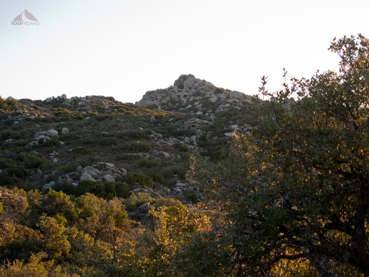
Bonny Benchmark from below

The view from Bonny to White, Thimble and Ysidro

Bonny Benchmark
Since I was more familiar with the terrain, we made it to Bonny in no time, hiking over a hump to the northeast, following a wash and then between two lower humps up to Bonny. The easiest way is up the east side and then travel clockwise around the southern edge of the summit block.
The view from here is already pretty spectacular, but this peak would be barely a bump in the distance by the time we got to Ysidro Benchmark.
Since the winds were calm, I was able to sign the summit register and noticed signatures from some climbing acquaintances, including Jeremy from socalpeaks.com, who had just done this same hike yesterday.

Heading up to White Benchmark
We scrambled down and headed to White Benchmark. Since last time the wind was heavier along the higher area to the west, we had stay in the lower areas on the way to White.
This time, I knew the ridgeline to the west would afford a far easier approach. We followed it, happy to see views to the west as we chatted and followed a little use trail that I wasn’t able to use the first time out. This use trail follows the barbed wire fence that marks the boundary between the park and private property. We were careful not to cross it.
After some steep sections that really spiked our heart rates, we passed Chief Rock and scrambled up to the top of White Benchmark.
It was only 8:30AM. We were making great time. I had visions of getting done relatively early, enjoying a nice lunch in Santa Ysabel and spending some time with my family at home. But we all know that never happens. Never.

Chief Rock

White Benchmark

The view south to Bonny BM and beyond
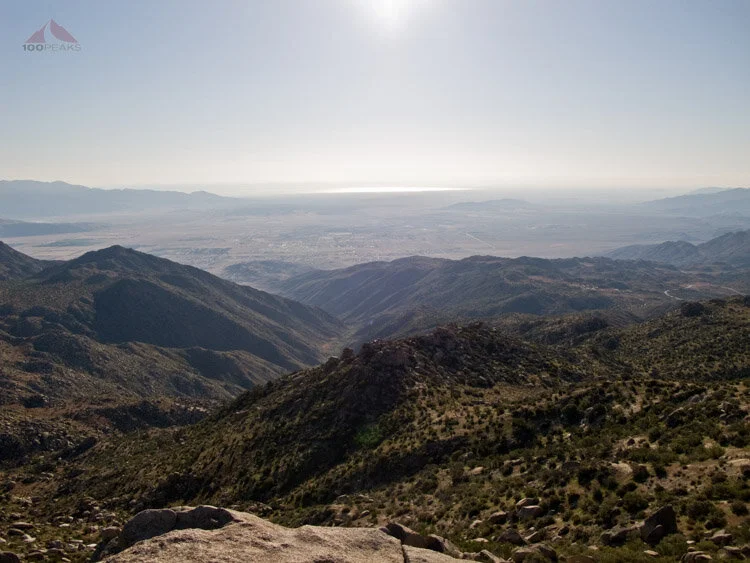
The view down Hellhole Canyon to Borrego Springs from White Benchmark

The view to The Thimble and Ysidro from White Benchmark
Feeling great, we headed down the north side of White, having to scramble here and there. It would probably have been easier to go back down west to Chief Rock and then turn north, but there are all sorts of directions one can take.
It was here that I turned around last time. But now, the way was free of snow, which had funneled us into brush and boulders.
This time the weather was great. I likely over-dressed, thinking that the cold would remain, and the day warmed up nicely.
We headed downward and across some small bumps, making sure not to trespass, and started the steep climb to the base of the large granite top of The Thimble. The whole time, I was scanning the cracks and slopes, looking for the easiest way up.
Since I am blogging about my hikes, and ultimately intending to guide people up with my words, I am not only trying to bag these peaks, but trying to find the best way up.
We scrambled up some rocks, mostly on the east side, angling upwards to the north, and then wrapped around clockwise to the south, where we found the chimney that I’ve read about in other trip reports. Before I shimmied up, I circumnavigated the entire eastern side of the peak, to make sure I wasn’t missing anything that might be a little easier, but I couldn’t find anything.
I shimmied up the chimney, scrambled up some steep granite and made it to the top. It was a nice peak, and my legs were getting a little tired.

The view to Ysidro BM from The Thimble
After a long rest (probably too long, but we were enjoying ourselves), we headed back down the way we came, dropping down the eastern slope of the Thimble and then working our way up to Ysidro.
We skirted the western side of the rocks to the north and found some cairns on the southern slope of the mountain which led us right to the top. We were tired and hungry and we were only halfway done for the day.
The weather was still good and the views were great. I loaded up on some calories and we headed back, taking the way eastward around the rocks to the south. It turned out to be quite a bushwhack, which slowed us down a great deal.

The north side of The Thimble, viewed from the way back

Snow Covered San Jacinto Peak from Ysidro BM
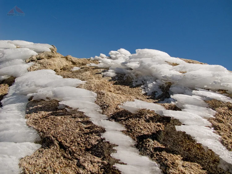
Ice near the top of Ysidro BM

Ysidro Benchmark
We followed mostly the same way back, skirting The Thimble and practically re-summiting White, and generally following the fence line until I knew it would lead us too far west, where the game trails would fade in and out, which would cause us to zig zag all over the place.
The valley had bloomed bright yellow beneath us while we were out hiking.

Vivid Anza-Borrego flower bloom on the way back
I found a great game trail that led to the road. We decided to follow that to the road and then head west.
We got back to the car at around 2:30PM, tired and elated after 8 hours of hiking. Since I was with others, I spent more time on the peaks than I typically do.
As we drove away, we could see 3 of the peaks we summited and were proud of what we accomplished.
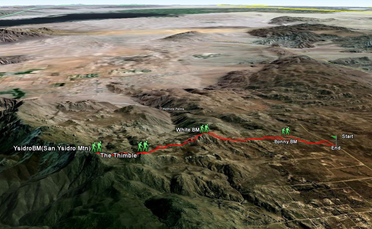
Bonny, White, The Thimble, Ysidro Map (Click to Enlarge)

