Chicken Spring Lake Backpacking Trip - Mother Nature had other plans
Chicken Spring Lake
Dates Visited: 08/10/2013-08/11/2013
For those interested, here is a list of my gear that I have found works well for me. This is, of course, an affiliate link and your enjoyment of these may vary:

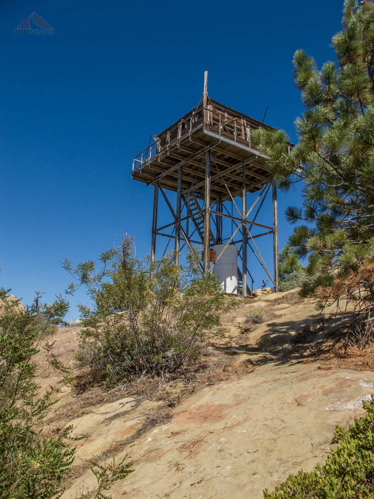
The Trailhead sign to Cottonwood Pass
08/10/2013
For this Summer's backpacking trip, I decided to invite a group of people that don't normally get into the outdoors. I searched for a place that was fairly accessible, yet still offered backpacking newcomers a glimpse of the beauty that is Sierra Nevada. Chicken Spring Lake, less than 5 miles from the Horseshoe Meadows Trailhead and with only around 1,200' of gain was an easy choice.
For this trip, a total of six of us went; my brothers -in-law. There was the PD, a staple in my adventures, (Here is an introductory post to the PD, if you haven't read it yet.), The Teacher, McD, McRonald, and Teo. We met at the Alabama Hills Cafe, for a hearty breakfast before heading into the hills.
We then walked around Lone Pine, scouting around for last-minute gear and asked about fishing in Chicken Spring Lake. We were told there were plenty of fish, of course by the person selling us a fishing license. We headed up to Horseshoe Meadows and got all of our gear into our backpacks and headed up the trail. I felt pretty good, since I had spent much of yesterday over 11,000' on my hike to White Mountain Peak, but others in the party had to take some time to adjust to the elevation.

Heading over Cottonwood Pass to Chicken Spring Lake
Right away, we could see Cottonwood Pass above us in the distance as we hiked through the soft sand adjacent to Horseshoe Meadows. We made some pretty good time over the flat section of the trail. Once we started climbing, though, the breaks naturally got more frequent. Occasionally, I would eye the darkening clouds suspiciously, but they appeared to be typical afternoon clouds over the Sierra Nevada. Any storm that would possibly come would be short lasting and expected.

The stowaway

Happy to be on the trail

Heading up to Cottonwood Pass
We stopped for lunch and looked up. Cottonwood Pass appeared to be very near. Once we started hiking again, though, we realized that the trail would swing way back to the left and then to the top of the pass.
From the top of the pass, we got a great view of Horseshoe Meadows and any of us with AT&T coverage had a signal. I texted status updates to our loved ones and we turned around and descended on the PCT toward Chicken Spring Lake.
Looking down to Horseshoe Meadows from near Cottonwood Pass
It's less than a mile from Cottonwood Pass to Chicken Spring Lake and most of that is level or slightly rolling. Leaving the others behind at the junction of the spur trail to Chicken Spring Lake, I scouted ahead to the west side of the lake, thinking that most groups would opt for the nearer east side and that the sun would hit our tents earlier on a chilly morning on the west side.
I found a great level area overlooking the lake, with plenty of room for all 4 of our tents and a nice kitchen area. No one else was on our side of the lake. I called to the group for them to come my way and we settled in for the night.
We had a nice dinner of pasta and wine. As dinner was cooking, I decided to take a stroll around the entire lake, watching the daylight fade into twilight. It is a pretty scenic lake and I was very happy with the lack of flying insects. I noticed a lot of tadpoles and beetles swimming in the shallows, but didn't see any fry or fish jumping. As I sat on the far edge of the lake, away from any campers, I almost felt like I had the lake to myself.

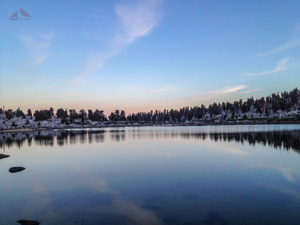
Chicken Spring Lake

Chicken Spring Lake
After dinner, most of our group decided to turn in, while the PD and I sat and passed a Sigg bottle of wine back and forth to each other for the next hour or so, watching the meteors burn up in the atmosphere, as well as some aggressive military jets and orbiting satellites speeding across the night sky. Suddenly, we both felt a chill, so we decided to turn in. In the middle of the night, I heard McRonald yell, "It's raining!" I thought to myself in my half-asleep state, "It's not a big deal, we're in tents."
It wasn't until the morning that I remembered that he had forgotten to bring the fly to his tent and had rigged up some trash bags in the darkness to offer him protection from the large drops that were falling last night. I offered him my footprint to my Big Agnes Copper Spur UL3 (truly a remarkable tent), which covered his tent a lot better than the trash bag rigging, and thought nothing more of it.
I slept pretty well, as when, in the morning, others let me know they heard an animal around the camp at night, I had no idea. I assumed it was a bear until Teo let me know that there were tracks by the lake that were not from a bear. I went to look around. It appeared to be an adult coyote with a juvenile. With the fresh rain, there were no human tracks nearby, so these were wild tracks.
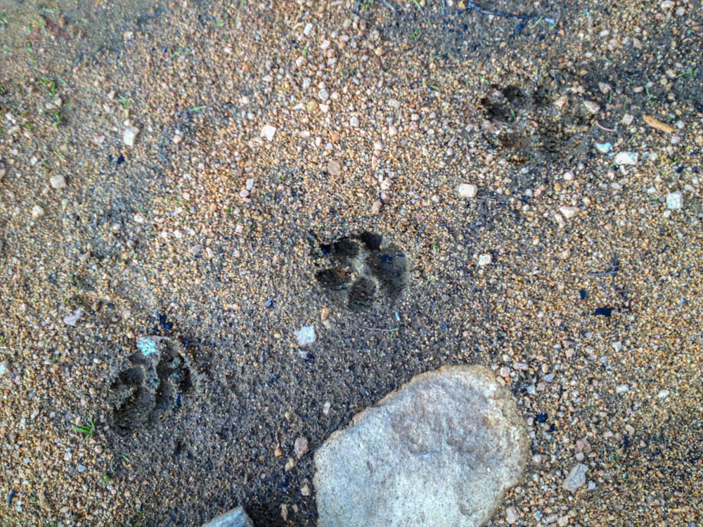
Signs of a late night visitor
Several of us grabbed our fishing poles and headed to the shores of Chicken Spring Lake. We were already skeptical about there being any fish in there, but we decided to try our luck anyway. After a couple of hours, alternating between sunny and sprinkling, we were convinced that there were no living fish in the lake. The PD, the Teacher, and I decided to go on a day hike.
I had my mind on possibly summiting Cirque Peak, and scoping out the section of the PCT that leads to Mount Langley. Once I got going, I was feeling pretty good and felt that I could put some miles in. We got on our day packs, making sure we had our shells, and headed up the PCT.

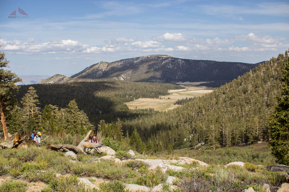
Pack Train on the Pacific Crest Trail
By the time we got to the ridge, about 15 minutes into the hike, we could see some clouds dropping rain in the distance and it started sprinkling fairly constantly. We donned our shells and kept hiking. Then it started raining. I was actually happy to see the rain. The smell of dampening earth and trees was intoxicating and the sound of it hissing all around us was pleasant.

The rain, approaching Chicken Spring Lake and the PCT
I remember on my 9 day Mount Whitney backpacking trip in 1984 that it rained eight out of nine days, lasting only for a few hours before moving off and allowing our gear to dry and I thought this would be the same. The rain intensified as we went further down the trail. We continued to slowly lose elevation as we traversed mostly along the contour lines on the map. We passed the talus slope that leads to Cirque Peak. I looked up into the rain and shook my head. The peak wasn't visible in the clouds. I would not be climbing to the top any time soon.
We decided to continue on the trail for a bit until I could see the trail wrapped around to the south up and over a small pass and ultimately to the Siberian Outpost. We were about 2.5 miles in and the rain was getting heavier. I called a halt to the hiking. I said we've gone far enough, and I didn't want to do 10 miles in the rain today.
We decided to descend a little bit and find some shelter under the trees. We sat, relatively protected and enjoyed our view of a small meadow. We hoped the rain would let up as we rested and ate some snacks. We stayed there about 20-30 minutes, watching several pack trains roll by from our hidden location.
It sure was pleasant, but the rain did not diminish. In fact, it actually increased. Resigned to hike back to camp in the rain, we collected our things and hit the trail again. I was determined to get back to the camp so that I could get dry. We kept a pretty good pace on the slight uphill. The trail was quickly becoming a stream and I tried my hardest to keep my shoes out of the icy water.
It was getting a little cold, but my activity level kept it bearable. I began to realize that I had neglected to close the vents on my shell, which I quickly did. My shirt was soaked. My pants were soaked. My feet were soaked. Everything was soaked. I kept my phone (and camera) in a waterproof pocket and rarely took it out. I was glad I had a dry tent and a change of clothes back at camp.
The rain never let up. The sandy trail become a rushing stream as we crested the final climb before the descent back into camp. We were a little tired. For me, this was three days of hiking and this last bit was a frenzy in the hope of keeping warm and getting back to a dry camp.
As we arrived at camp, that hope was dashed. The same rivulets that were running down the mountain above were running through camp down below. A pond was forming in our campsite, already touching two of our tents. McRonald's tent was soaked, my tent was without a footprint, Teo's tent was waterlogged and the remaining tent had small leaks. The Teacher was concerned, as he didn't have a set of dry clothes. The PD and I walked around the area, searching for a better place to move the tents, but everything was pretty wet.
I was lining up facts in my head:
The Teacher didn't have a change of clothes (several campmates didn't)
I was already shivering from being completely soaked
It had been raining nonstop for about 3.5 hours
I didn't know how much longer it would rain
Campfires are prohibited over 10,000' (All the wood was likely wet anyway)
We were down to two dryish tents for 6 people and mine didn't have a footprint
I would hate to experience increased flooded conditions in the middle of the night
I was getting too old for this. This was supposed to be an active vacation, not suffering
I made the call to get down the mountain. It was 2:30PM. We called out, "Let's get everything packed up and be on the trail in 1 hour." A flurry of activity ensued. It was pouring rain. Everything was wet. The PD rigged a tarp in one corner of the camp as a packing and staging area. We stuffed soaking wet gear into our packs. The spirit of teamwork was inspiring as everyone stepped up and did their part.
At 3:15PM, we were ready to go. We had packed four tents and 6 peoples' gear, food, stoves, etc., in 45 minutes, all during an intense downpour. We were motivated to get warm and dry. I was eager to start hiking, since I started shivering whenever I stood still. In hindsight, I should have changed into a merino base-layer, instead of my synthetic ExOfficio shirt, but I was reluctant to expose myself to the rain and cold to make that change. I will next time.
We made great time, since the elevation didn't have a negative effect on us going down. The rain continued to fall as I continued to step around the creek that was the trail. As I started to get a little tired at the end, sinking into the soft sand near Horseshoe Meadows, I started to think about some of the luxuries I had brought on the trip: two bottles of wine (in Sigg bottles), an REI Flex Lite Chair, iPad Mini for reading, a Power Monkey Extreme solar charging system, extra clothes, my Canon Rebel T3i, among other items. My pack was heavy, but simply because I knew it was going to be an easy trail. But my backpack (an Osprey Exos 58 that I will never give up until it falls apart) wasn't made for all that gear, so there was too much weight on my shoulders, which were aching. I kept hoisting the pack up for some relief. My words to the PD came to haunt me, "I don't want to hike for 10 miles in the rain today." Which is exactly what I ended up doing anyway.
At this time, it was easier just to walk in the water. My socks couldn't get any wetter and the other way was just tiring me out. It was a relief to finally see the trailhead again. It had taken about 2.5 hours. It had been raining on us for 7.5 hours so far.
I had images of quickly digging my car key out, throwing my soaking wet pack into the back, and cranking on the heater while I sat in my wet clothes and warmed up. However, just barely sitting in my front seat left it pretty wet. I needed to change. I went back out into the rain and around to the back of the car and dug into my backpack, pulling out my dry shorts, wool long sleeve base-layer, and clean underwear. When I said everything was wet, I meant everything. I also grabbed my sandals. I changed in the trailhead restrooms, peeling my clothes off and wringing them out. Once in dry clothes, I was instantly warm. I walked back to the car, aware that my completely wet clothes likely added several pounds to the weight I had been carrying along the trail.
I returned to the car and briefly enjoyed the heater. Two from our group were not back to the car yet, so I went to the back of my car and started putting on my more rugged sandals. My muddy and worn-out trail runners were destined for the trash can. As I started back on the trail to see if I could perhaps carry one of their packs if they were exhausted, I turned around to see that the final two members of our party had returned safely.
There were no pictures from this part of the trip, since my DSLR was stowed safely in the recesses of my pack and my iPhone was zipped tightly in a waterproof pocket. Even so, it was covered with moisture when I finally retrieved it. I was happy that I had packed my Columbia Peak 2 Peak shell, rather than something lighter, because this is what kept me warm when I was wet and kept me dry for as long as it did. It was my fault for not rezipping the vents.
Everyone got as dry as they could and we drove off the mountain. It was still raining.
We had some pizza at The Pizza Factory in Lone Pine. The pizza was good and the service was great. Over beer, we decided what we wanted to do. Since the rains had been relentless all day, the hotels in Lone Pine were full of campers seeking refuge from the deluge. We made some calls and found two rooms at a Hotel in Bishop. We would get a good night's sleep and go fishing the next day.
Outside, it was still raining. It was a lot lighter down in Owens Valley, but up in the mountains, the clouds still looked pretty fierce. Walking around town, we turned and looked and saw Mount Whitney, bathed in alpenglow. It was amazing. It would rain for over 11 hours. It reaffirmed my decision to get off the mountain.

Sunset over Mount Whitney from Lone Pine
We woke up and went out for breakfast, stopping at Schat's Bakery along the way. For some reason, while buying bread, I like to go in and look at Kurt Wedberg's sign that was posted when he climbed Mount Everest. The PD and I attended his free talk at Adventure 16 before we did Mount Whitney in 2010. He is a great guy and continues to lead expeditions around the world.
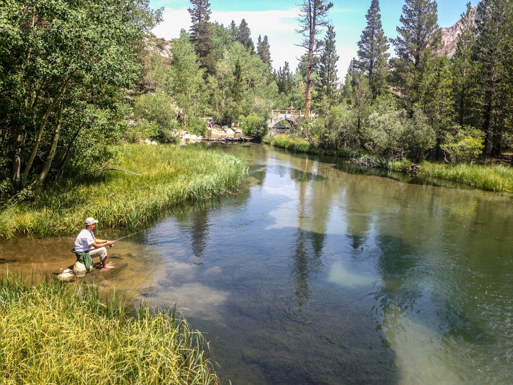
We drove up to Lake Sabrina, where the water was pretty low. The view of the mountains was awesome, but the lake just looked depressing. However, along the way we saw plenty of places along Bishop Creek to fish. We drove down and got out our gear. The water was filled with trout that apparently were not hungry. We cast and cast, using a variety of lures, but it was likely the wrong time of day and this place got a lot of visitors. The fish were leery of anything in the water.
Regardless, it was a beautiful morning.

Fishing for trout in the Middle Fork of Bishop Creek
Fishing for trout in the Middle Fork of Bishop Creek
We then decided to have a picnic at the Cardinal Village Resort and take a hike to a waterfall we saw from the highway. We hung out at their little market, cooked some hot dogs and ramen on their picnic table. Teo found a small garter snake and we all took turns handling it until we put it pack into the brush.
We took a hike up the trail. It was lush and green and we could hear the roaring of the waterfall immediately. It was about 300' high and I later learned that it was called Goldmine Falls. I climbed onto some rocks into the middle of the waterway and basked in the sound and negative ions. The clouds started to roll in.
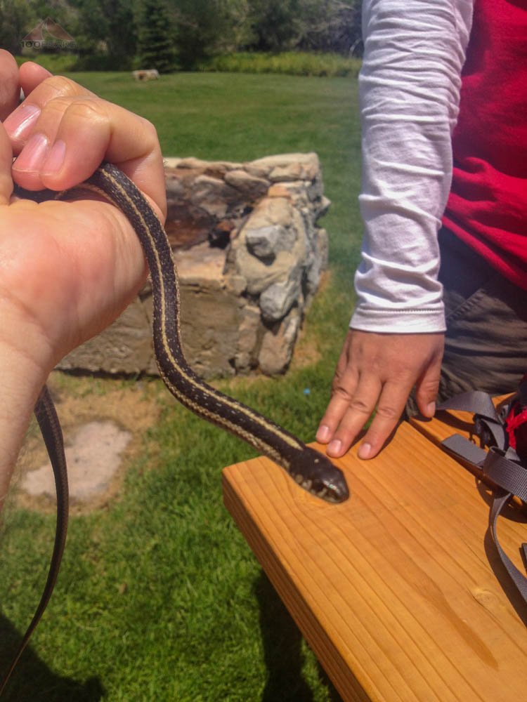
Found a friendly Garter Snake

Hiking to Goldmine Falls near Cardinal Village Resort

Middle Fork of Bishop Creek

Goldmine Falls
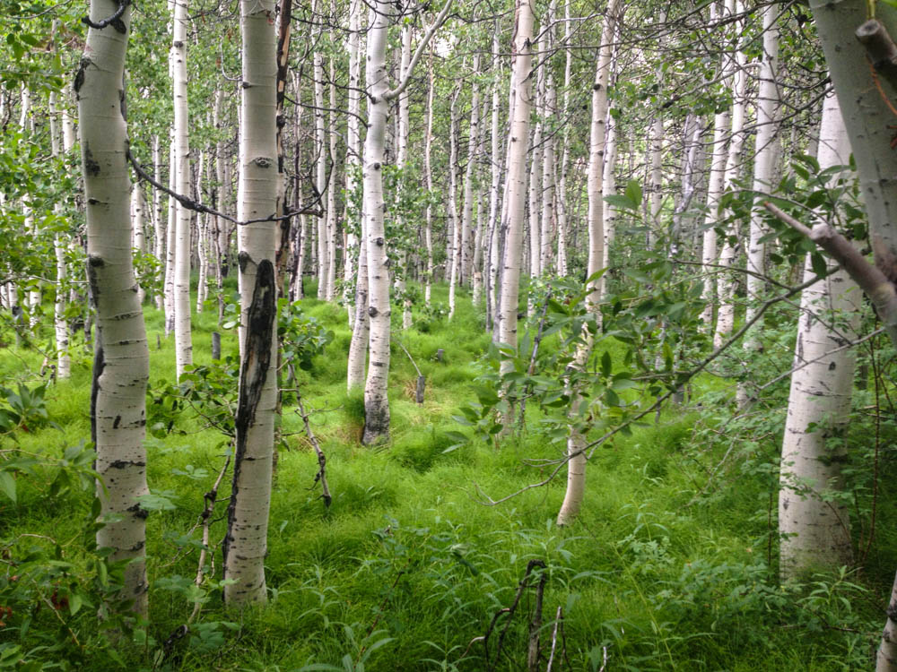
Aspen Forest
We made it back to the resort and decided to try our hands at fishing again. There was a little pond nearby with some visible trout. We got our fishing gear ready and walked the short distance to the pond. Immediately, before we cast the first cast, the sky opened up and marble-sized rain drops pelted us. We deemed we'd had enough rain for one trip and headed back down the mountain and headed home.

The Sky Opens up
Overall, the trip wasn't exactly what I had planned, but we had a great time, explored new areas, and we all learned a little about the outdoors, and each other.
Once I got home, I read about other groups who had aborted their Sierra Nevada adventures due to the rain. These were seasoned hiking veterans and ultra trail runners.
I made the right call.