Black Mountain - Peak #2 - Foggy at the top
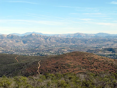
Panoramic view from Black Mountain to the west
Black Mountain
Elevation: 1,552’
Mileage: Various
Trailhead: Various
Agency: Black Mountain Open Space Park (City of San Diego)
Dates Hiked: 24 times (so far), starting on 09/08/2008 and most recently on 10/20/2021
Peakbagger.com page
For those interested, here is a list of my gear that I have found works well for me. This is, of course, an affiliate link and your enjoyment of these may vary:
Black Mountain Open Space Park Trail Map (Original PDF is at the link above)
07/03/2009
I got up early and summited Black Mountain this morning. It was so foggy that I almost took the wrong trail a couple of times. Even about 1/4 of a mile away from the peak, I still couldn't see it.
Just when you think the trail is steep, it gets steeper. There wasn't much view from the top, except a nice purple flower blooming.
Update:
I've been up this mountain so many times since this first “official” 100 Peaks summit, that I have lost count (at least 24). One of my favorite ways used to be to drive to Hilltop Community Park and head up with a headlamp just before dawn and watch the sunrise over Iron Mountain and The Cuyamacas from the summit. It is a great sight to see and a complete reward for gaining ~900' in two miles. I then jog the whole way down, taking it easy in the really rocky sections. I've seen some other regulars making their way up just as I am almost back to my car at Hilltop Community Park.
Since then, I’ve been favoring the Miner’s Ridge Loop.
Lately, I’ve been able to summit this from my house, making it 11-13 miles, depending on which trails I choose to take.
Update 01/01/2010:
New picture from the peak:

A view from Black Mountain to the North
Update Jan 2011:

Panoramic View from Black Mountain
Update 06/17/2011:
I have ascended this mountain from several different directions, since I can see it from my home office and use it for training. As a matter of fact, I am looking at it right now. My favorite route is indicated on the map below, due to the easy parking and the even 4 miles round trip with about 900' of gain/loss.

Black Mountain Map Trail Master
Update 06/25/2011: Another panoramic photo from the top.

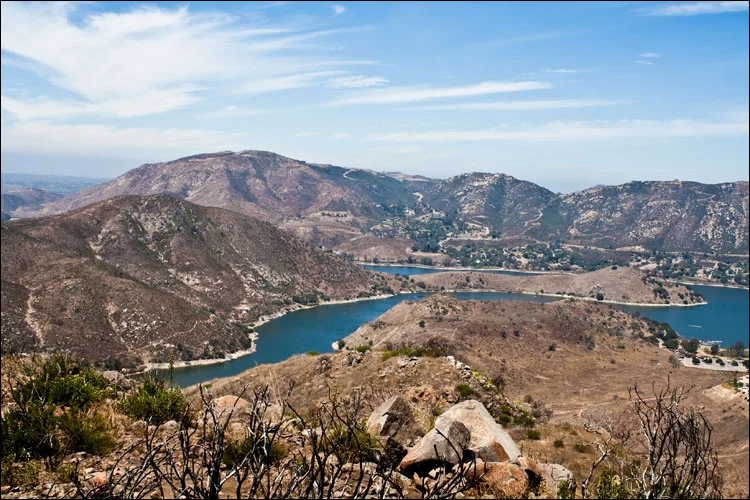
Black Mountain panorama to the east

A view from Black Mountain to the East