


Villager and Rabbit Peaks - Peak #28 - Steep Desert Ridge with a View

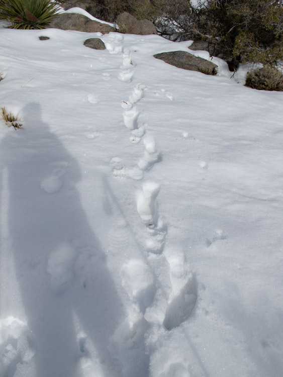
On the way to the ridge
Villager Peak
Elevation: 5,756′
Miles: ~13.78
Dates Hiked: 01/30/2010, 10/19/2019
Peakbagger.com Page
Rabbit Peak (Riverside County)
Elevation: 6,640′
Miles: ~8.9 (in additional to Villager Peak)
Date Hiked: 01/31/2010
Peakbagger.com Page
Agency: Anza-Borrego Desert State Park
Trailhead: Villager Peak Trailhead
For those interested, here is a list of my gear that I have found works well for me. This is, of course, an affiliate link and your enjoyment of these may vary:
Update: I summited Villager Peak as a day hike in 2019, as well as hiked about halfway up in 2018, and found that the trail, though still easily lost, is more pronounced than it was in 2010, as the popularity of the hike has increased in the last decade or so.
01/30/2010
This was my first peak summiting with a group (Gut Check Fitness with Joe Decker) and the first overnight trip, as well. I had been wanting to do this hike for a long time, since the epic scope of it seemed unlike any other hike in San Diego.
Although I summited two peaks on this trip, only Villager Peak counts as a San Diego peak, since Rabbit Peak is in Riverside County. Both peaks, however, are on the Hundred Peaks Section of the Los Angeles Chapter of the Sierra Club.
Unless you camp the night before in Anza-Borrego Desert State Park, which we didn't, you are bound to get a somewhat late start on the trail, since the trail head is nearly two hours from almost anywhere in San Diego. We strapped our packs on and immediately headed across the desert floor to the ridge that rose up in front of us, like a ramp into the mountains.
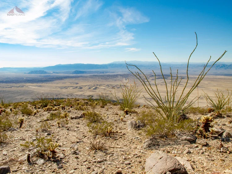
Ocotillo on the way to Villager Peak
It was pretty warm for a late January morning, so I begun to wonder if I was wearing too much, specifically my Ex Officio Borocade Pant (as of 2023, Ex Officio sadly no longer makes anything other than base layers), which seemed like it might be a little thick. However, after people started getting punctured by sharp desert plants and the temperature plummeted as we gained elevation, I realized that the thicker pants were a good choice.
The first mile was pretty flat and it was pretty evident which ridgeline led up into the sky. We were immediately welcomed by various cacti, including cholla, ocotillo, prickly pear, and barrel cacti.
The trail was hard to see, and from time to time I found myself struggling to get back on it. Several members of the group stopped for an early lunch and a comfortable group of rocks, but since the pack felt pretty heavy and I wasn't quite hungry yet, I decided to press on.

The Clark Valley drop-off
This definitely felt different than my typical day hikes with a lumbar pack. I was carrying 6 liters of water which translates to over 13 pounds. My pack weighed about 40 pounds total, which is a far cry from my heavy pack of the eighties that carried a week's worth of food and steel pots and pans, but it was a shock to my muscles, which weren't used to carrying the weight.

Toro Peak on the way to Villager Peak
The trail continued climbing upward, gaining nearly 5,000' of elevation, most of it in about 5 miles. Sometimes the trail was mere feet away from a several-thousand foot cliff. The views to the valley floor and to the Santa Rosa Mountains before us were amazing. I could see Toro Peak in the distance, covered in snow.

The rugged trail to Villager Peak
My pace started to slow down and I took more frequent breaks when I finally stopped for lunch. About an hour after lunch, I could feel the effects of the food and I got my second wind, making my way up and over the many knobs on the way to Villager Peak.
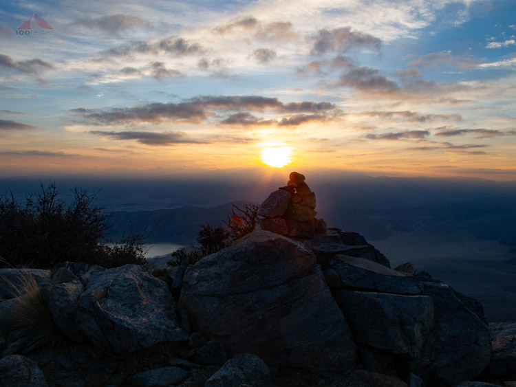
Sunset over the Villager Peak cairn

Looking down to Clark Valley with Rabbit Peak in the distance
When I reached the campsite. I was pretty tired. The extra weight of the pack, the tremendous elevation gain, and the constant vigilance while looking for the trail had worn me out.
We had a great time socializing at the campsite and watched as an amazing orange moon rose over the Salton Sea, but when it was time for sleep, we all enthusiastically dove into our sleeping bags.
When I woke up in the morning, my pack was completely covered in frost. It was hard to get out of my warm sleeping bag, but I was encouraged by the lure of Rabbit Peak. And Joe's robust persistence.

Frosty backpack on Villager Peak
The sunrise the next morning was beautiful as many of us strapped on our day packs and continued on the ridge line north to Rabbit Peak.
Most reports indicate mileage is 3.5 miles to Rabbit Peak, but my GPS showed that it was 4.45 miles each way. And it felt like it.
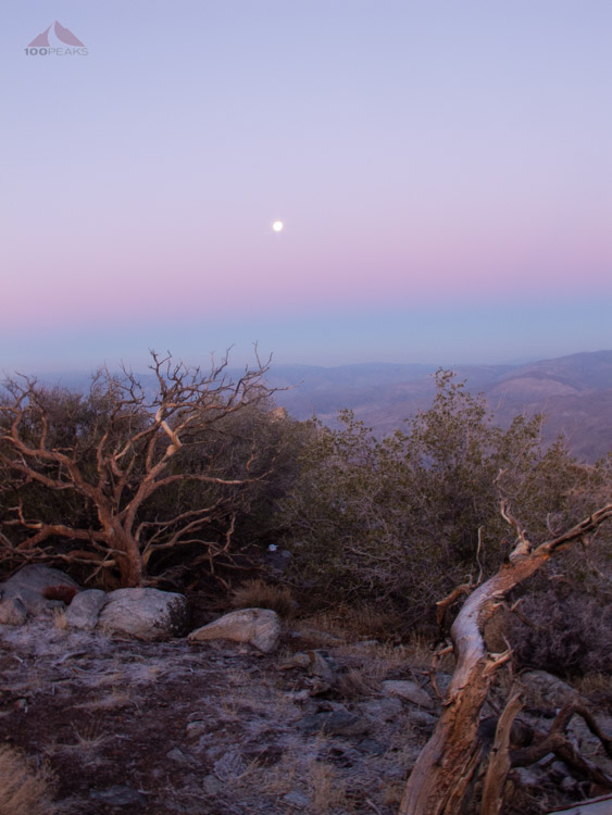
Moon in the sunrise on the way to Rabbit Peak

The PD on the way up to Rabbit Peak, with a snow-covered Toro Peak in the distance
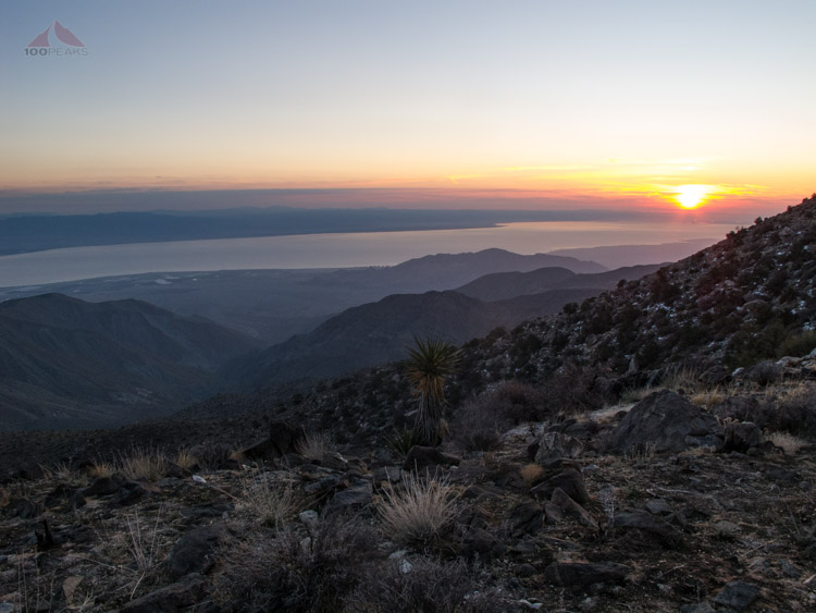
Salton Sea sunrise

Toro Peak on the way to Rabbit Peak
We followed the ridge line up and down until we got to the base of Rabbit Peak. From there, it is a one mile climb, gaining more than 1,000 feet.
The top of Rabbit Peak was covered in snow and we had a snack, took some pictures and headed on down. We needed to make good time, since we still had over 11 miles to go before the sun went back down on the other side of us.

On the way up to Rabbit Peak

Interesting tree below Rabbit Peak
Several hours later, a small group of us made it back to Villager Peak and quickly packed our camp up and headed back down the mountain. The good news is that our packs were lighter due to having drank a lot of our water. The bad news was that we drank a lot of our water.
All three of us thought we had more water than we had. We decided to ration our water and a couple of us scooped up some snow into our water bottles as an emergency supply, which didn’t really melt as fast as we’d hoped.
One of us had a water cache many miles down the mountain, but the PD and I had to watch our intake.
Snow on Rabbit Peak

The PD at the top of Rabbit Peak
Villager Peak from Rabbit Peak
I continued down the mountain, noticing that the trail was much easier to follow on the way down, and my trekking poles saved my knees a lot of fatigue. Much of the trail I did not recognize, since I took a slightly different path on the way up, having lost the trail many times. We found the water cache and were delighted that Joe had left a gallon of water with the other cache. We rehydrated and had some reserve water, so our morale was boosted.
I sped down the mountain, racing the sun as it dropped to our right. I reached the desert floor and could see the car at the trailhead in the distance. After countless minutes of trudging in the sand, it seemed we would never arrive at the car.
We finally made it, and our comrades had left us some liquids at the car, which we quickly drank. We had some food in Julian and made our way home.
Overall, it was an exhausting but incredible trip. Some things that I learned:
Most of my gear is pretty solid.
Wearing my trail running shoes was sufficient. The last couple of times I wore hiking boots left my feet tore up.
Trekking poles are a lifesaver. These weren't really around when I was backpacking as a child.
Never underestimate the amount of water you will need in the desert.
You can never get up too early to complete this hike. The treacherous ridge, the faint strail, the elevation gain/loss, and the sheer mileage takes a lot of time.
I would do it again in a heartbeat.

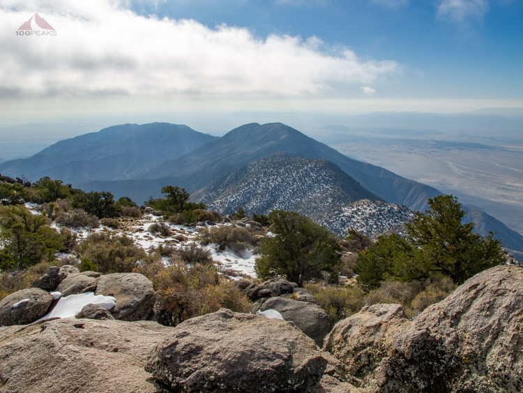
Villager Peak view from 2019
View from the Villager Peak Trail in 2018
