


Bell Bluff - Peak 64 - A vigorous bushwhack over the Sweetwater River
Bell Bluff
Elevation: 3,409′
Mileage: 7
Trailhead: Via Dieguenos Trailhead
Agency: Cleveland National Forest
Date Hiked: 07/05/2011
Peakbagger.com Page
For those interested, here is a list of my gear that I have found works well for me. This is, of course, an affiliate link and your enjoyment of these may vary:
07/05/2011
It was going to be a hot day. And there was going to be bushwhacking. I knew it before getting into this. I had read the trip reports and did all the research I could. I was as prepared as I was going to get. Against my better judgement, I wore shorts. I would accept the deep scratches on my legs as a trade-off for being slightly cooler.
I left my house at about 6AM. The sky was already grey with the promise of a new day when I arose at 5AM. It was already warm. I've told plenty of hikers that, as long as you carry enough water, have the property clothing and sun protection, and have an adequate level of fitness, you'll be fine hiking in the heat.
But today was absolutely muggy. The humidity made me start sweating the second I closed the hatch on my car and started walking down the street to the trailhead. It was a little sweltering, until the breeze came, reminding me why it's so great to be outside.

Bell Bluff Trailhead - California Riding and Hiking Trail

Ladder across the Sweetwater River
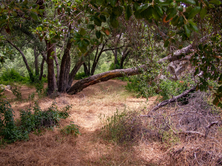
Spanish Bit Trail through the Oaks

View to the north along Spanish Bit Trail
I started up the trail between two private homes. I had parked down the street at a wide spot on the road.
Being mindful of the early hour, I recorded my trailhead video down a bit where the trail crossed the Sweetwater River. Other trip reports had led me to believe that I was going to have to remove my shoes and cross this portion of the trail, or else I would get my socks wet. However, some trail angel had left a long ladder over the river. My feet stayed dry.
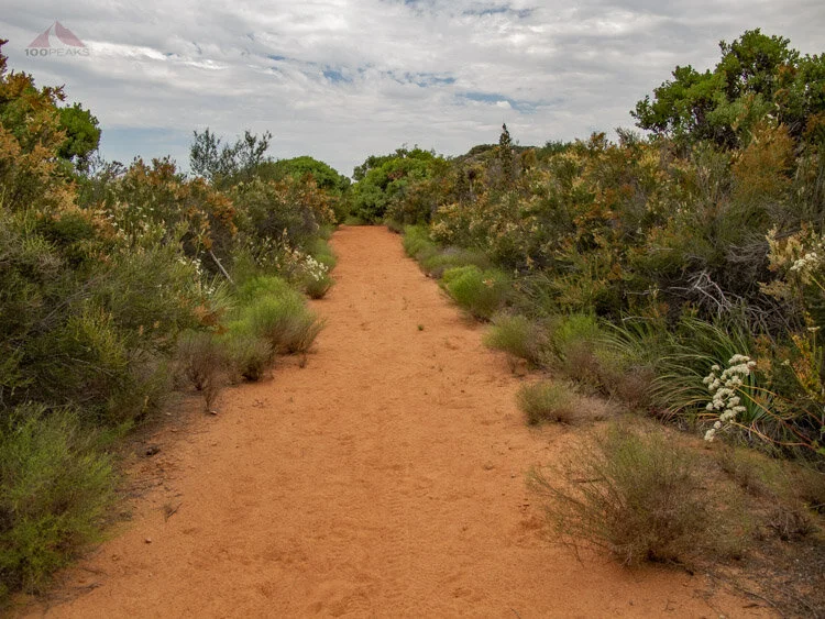
Spanish Bit Trail, flanked by manzanitas
Before long, I was out of the oak-shaded part of the trail and out onto another truck trail, where once a car was able to drive, but now had been choked by brush into a single trail, only sometimes exposing the double tire tracks of the old way.
Luckily the high cloud cover remained over me as I slowly climbed eastward. After about a mile, Bell Bluff came into view and stayed there until I reached its base. The granitic butte dominated the area, and I started wondering how hard it would be to get to the top.

Bell Bluff from Spanish Bit Trail
Since the first part of the trail was pretty straightforward and didn't have much gain, it didn't take long before I was at the base of the mountain.
I found an open area where most trip reports indicated they started bushwhacking to the top. The reports also mentioned some green ribbons tied to the brush that show an easier path to the top. I zig-zagged all over the area, and did not find any ribbons.
Not wanting to waste any more time, I began the bushwhack, which was actually delightful at first. I found a trail which led directly to a large dark cave, with no way around it. It was a game trail, perhaps for a mountain lion. Realizing this was not the correct way, I started bushwhacking another way.
I then came upon an impenetrable wall of brush, mostly manzanita. I had foolishly thought that I would be able to muscle my way through anything that came my way.
After all, I had been to Middle Peak and had chosen a challenging path home from Los Pinos Mountain. However, I realized I really should find this "path" up the mountain if I was going to be able to get through this without losing an eyeball, or worse.
Aware that my GPS track was going to be a work of art, I started criss-crossing the steep mountain side, only to be foiled by another solid wall of brush.
In one open clearing, I saw a little green ribbon on the ground. It could have come from anywhere. I felt like I was on the right path, but there was truly no where to go. After searching a few more times, I felt like I was probably too far north and needed to head west.
Avoiding the wily poison oak that seemed to hide itself within holly bushes, I lumbered laterally through the brush of least resistance.
After about 50 feet of swimming through the chaparral, without my feet touching with ground, I came across a small wash. Choked by plants on either side, I could sense a way if I crouched and started upward. I made quick progress.
I had been bushwhacking for over an hour, while traveling only about .2 miles from the trail. I was excited.
I passed by a large boulder, seeing some ferns growing in a cave underneath. Encountering more poison oak, I wished that I had worn pants. I saw a green ribbon tied to a bush. I was on the trail! It existed!

Ferns Growing in a Small Cave on the west side of Bell Bluff
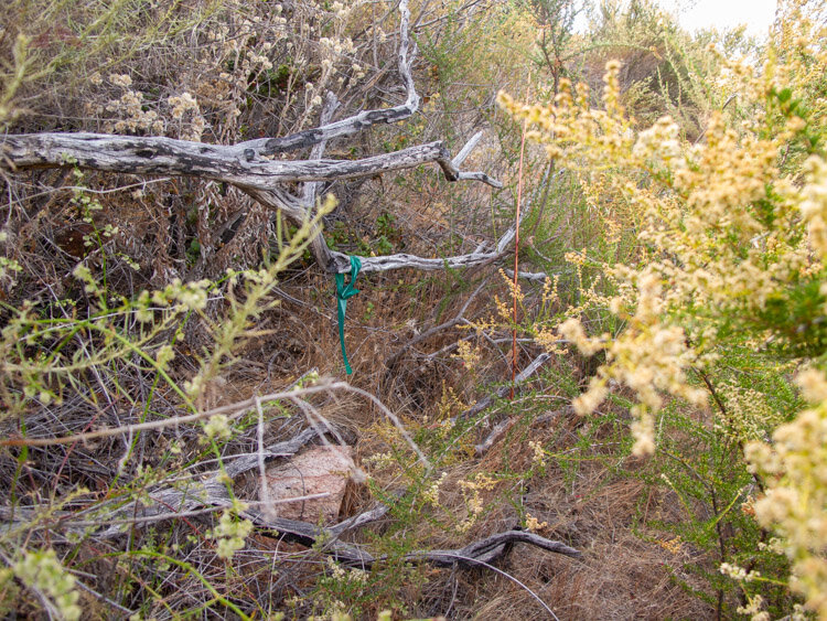
Green Ribbon on Bell Bluff, probably not the best color choice
Before long, I was actually on a clearly defined matted trail through some grass on the steep mountainside. The sun came out and started baking me as I made the steep ascent through the boulders and brush. I had made it to the top.
The breeze was nice, but the flies were out in force. I started thinking that perhaps I had not taken advantage of the cold winter, but then remembered how wet it was. This winter, I will look out for those cold, dry days.

Not much of a trail to the top of Bell Bluff
I could see many of the peaks that I had climbed, like Viejas Mountain, El Cajon Mountain, Lawson and Gaskill Peaks.
The breeze was nice and I was able to climb up the summit block into a sheltered area that actually had some shade. I could see and hear the construction of the Sunrise Powerlink Bell Bluff Station to the east. I was happy that it wasn't going to be located on the top of Bell Bluff, as I had thought.

Viejas Mountain from the top of Bell Bluff

Palo Verde Lake and Loveland Reservoir from the top of Bell Bluff

Sunrise Powerlink to the east of Bell Bluff

Lawson, Gaskill and Lyons Peaks, and Otay Mountain from Bell Bluff
Red ants started aggressively climbing up my shoes and the flies got my scent, so I started on the way down. I followed my path, losing it here and there, until I was truly bushwhacking again. I am certain the green ribbons are missing from the lower half of the summit trail. In between the rocky areas, I was able to jog a little bit on the way down.
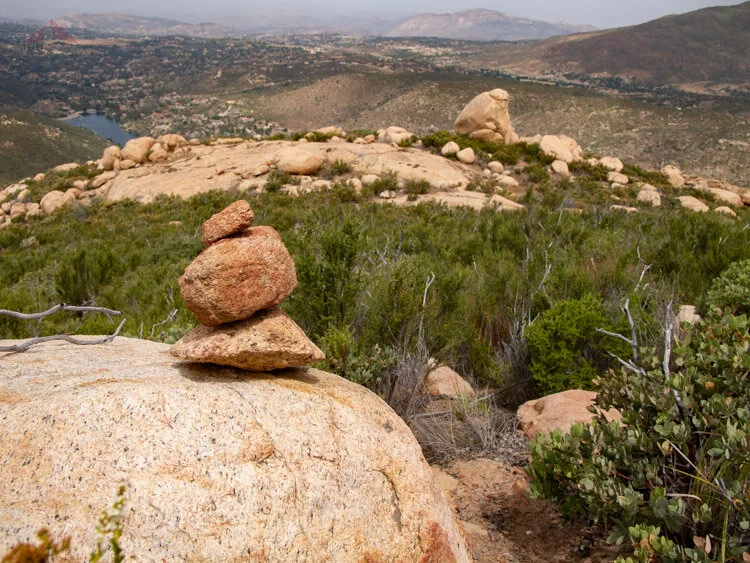
Cairn on the way down Bell Bluff
I made it back to the car, thankful for the air conditioning and change of clothing that I had brought. I was covered with dirt and soot, since you can't bushwhack anywhere in San Diego without encountering burnt brush and trees.
My legs were stinging, covered in scratches from my bushwhacking experience. I was OK with it. I had to be. It was my choice. At least my legs had been cool.
And at least I didn't rub against any poison oak, or lose an eye.
Bell Bluff Trail Map (Click to enlarge)
Bell Bluff Trail Map - Detail (Click to enlarge)
Approximate Route - Annotated picture of Bell Bluff
