


Montecito Peak - SB Peak #1 - My first hike in Santa Barbara
Montecito Peak
Elevation: 3,214′
Miles: 2.4
Trailhead: Cold Spring Saddle (from the north) or Cold Spring Trailhead (from the south)
Agency: Los Padres National Forest
Dates Hiked: 11/27/2011, 10/03/2012, 02/24/2013
Peakbagger.com Page
For those interested, here is a list of my gear that I have found works well for me. This is, of course, an affiliate link and your enjoyment of these may vary:

Monetico Peak from Cold Springs Trail
11/27/2011
While planning for this peak, I had the option of hiking this from the south, or accessing it from the north, on Camino Cielo. Since I am just getting back into hiking shape, I decided on the shorter route from the Cold Spring Saddle, at the top of the ridge.
I was pumped to get going in this hike, it being my first hike since my last San Diego to Mount Tule, about 2 months ago. It was still dark when I pulled my covers back and entered the cool air of the morning.
I drove the winding road leading up to the high ridge. There were other people, parked here and there, standing outside their cars to capture the full beauty of the orange and purple sky and the sun rising over the ocean.

Sunrise from Camino Cielo
I pulled off the road into the trailhead area and smelled my first smell of the Santa Barbara mountains. To be honest, they smelled very similar to the San Diego mountains. From the ridge, I could see off to the north, where larger mountains beckoned and the Cold Springs Trail dropped down into the valley below.
It was about this time, I realized that I had left my normal video and still cameras at home. After packing and unpacking my entire house, I am still in need of refining my methods.
Most weekends involving 6-8 hours of driving to San Diego or Orange County. We promised ourselves that we would turn down long distance social engagements, but this hasn't happened yet.
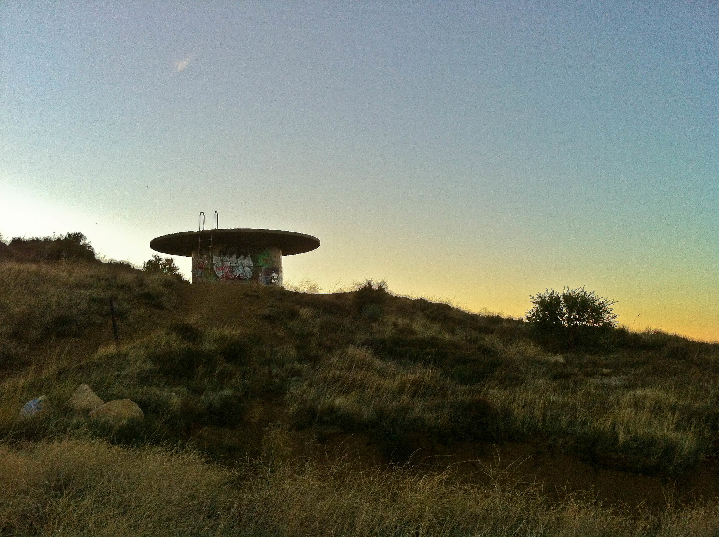
Water tank at Montecito Peak trail head
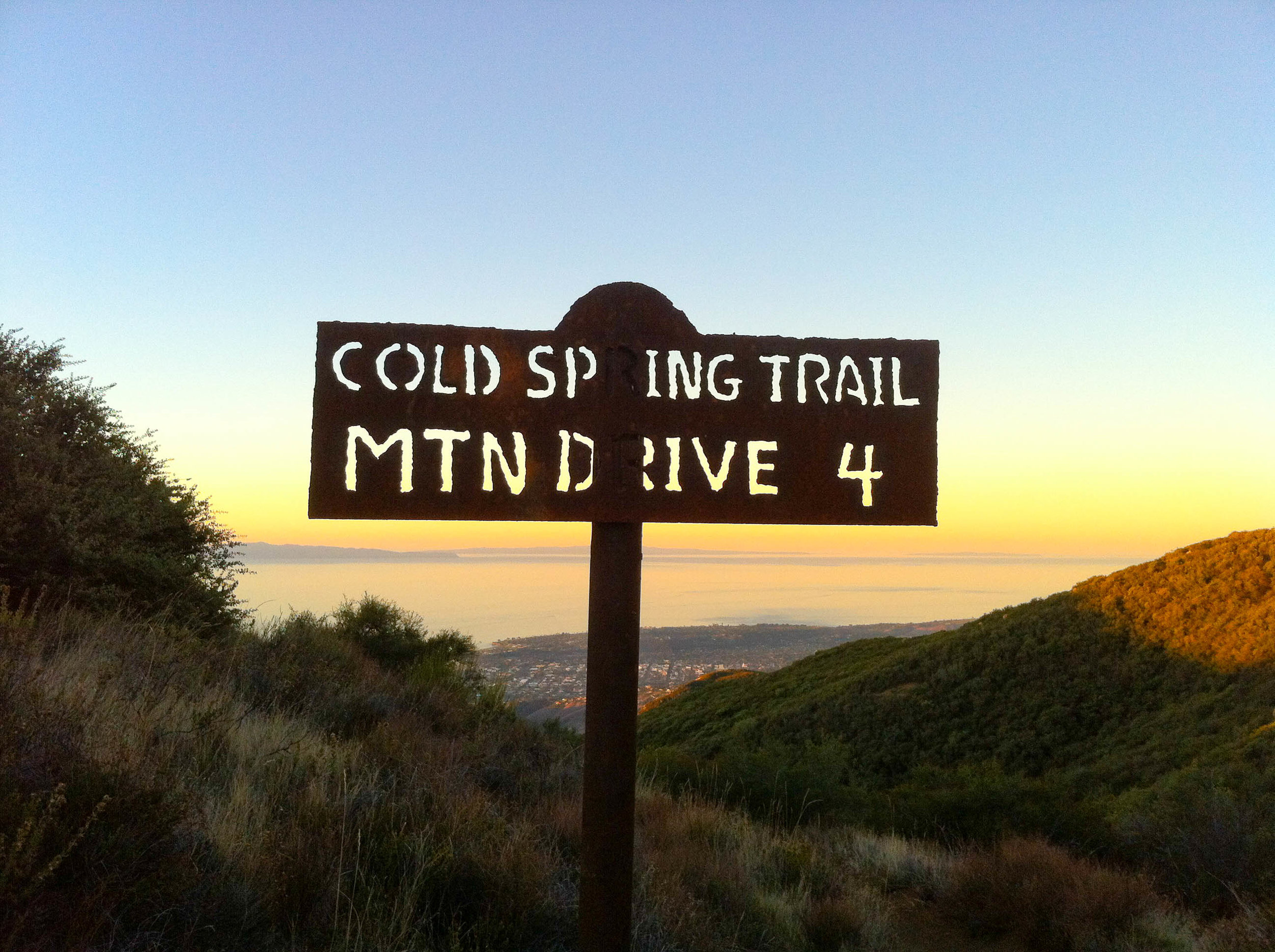
Sign at Montecito Peak Trail head
Still a little cool, I set out on the trail. Before long, I passed a little sign that encouraged the use of bells to alert other trail users. I looked inside and there were no bells.

Mountain bike bells at Montecito Peak Trail head
This hike was several firsts for me.
For one, it was my first Santa Barbara Peak that I had hiked.
Secondly, it was the first time that I would ever lose elevation getting to a peak. The ridge from Camino Cielo was higher than the peak. I would see what it felt like on the way back. I felt my legs warm up and get back into my rhythm of hiking. I could tell that some minor muscles here and there would be sore, but it felt great to be back on the trail.
Every bend in the trail would reveal a stunning view of the ocean below as Montecito Peak came into view.
Scanning the trail to my left, I eventually found one of several use trails that lead to Montecito Peak's ridge. Soon after, the trail really got steep and it was here that my current level of fitness was put to the test, which it failed miserably.
As I scrambled up the steep slope, I could tell that my body needed some cardio exercise to get it back into shape, but my mind didn't lose the zen-state it gets into while hiking.
Sure you can huff and puff while hiking up a trail, but, somehow, your mind takes care of the body, stopping when necessary or slowing or quickening the pace as needed. It's nice to feel that mindset fit like a glove.
The sun finally touched me as I reached the peak and drank in the panoramic views. I had the peak to myself. I sat on a rock and signed the summit register.
This was my new home. My new place of exploration. The vegetation and soil was mostly the same, and I have heard there are turkeys, deer, and coyotes around, but I am sure going to have to put up with much more fog than I am used to.
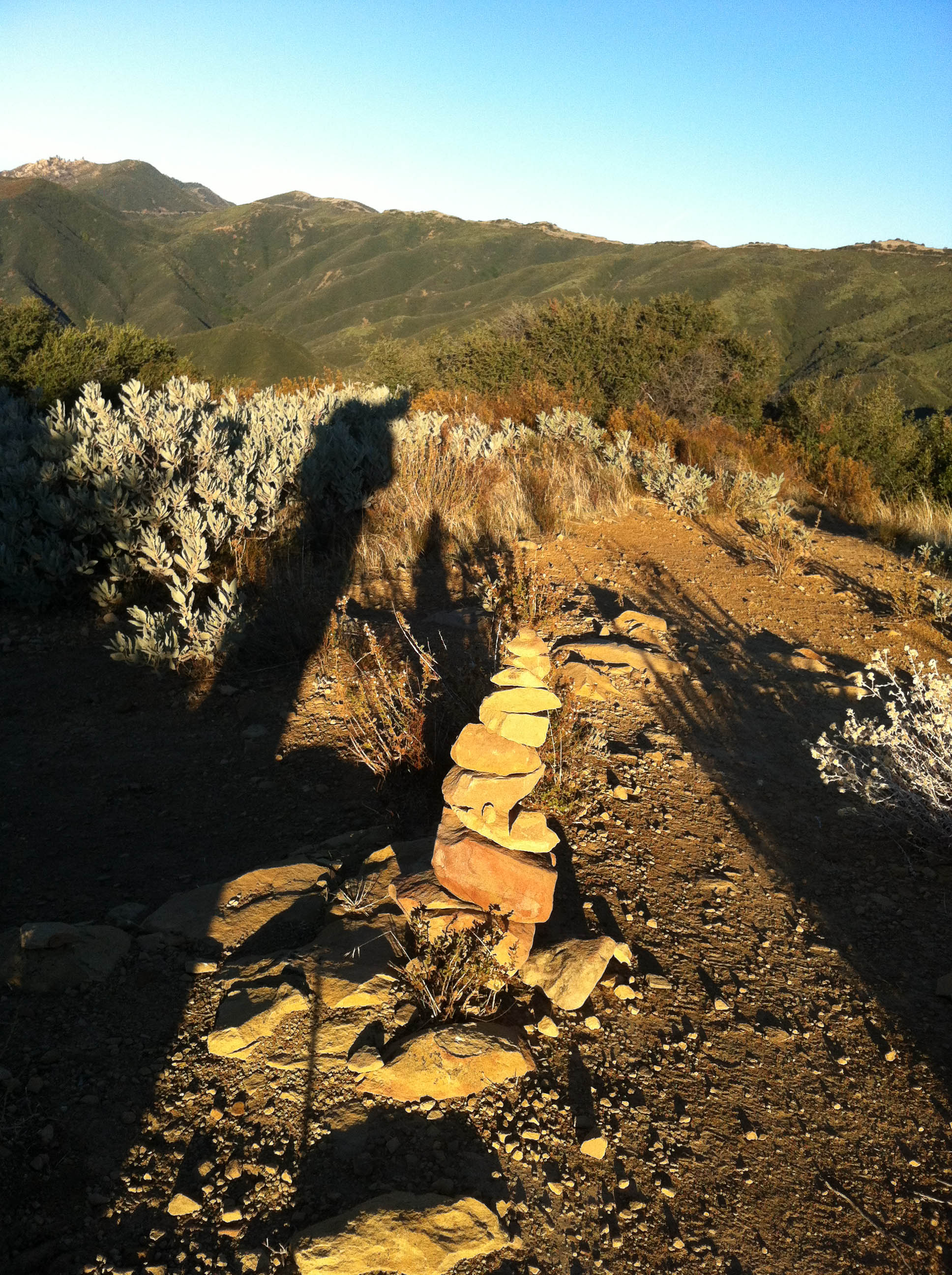
Cairn at the top of Montecito Peak
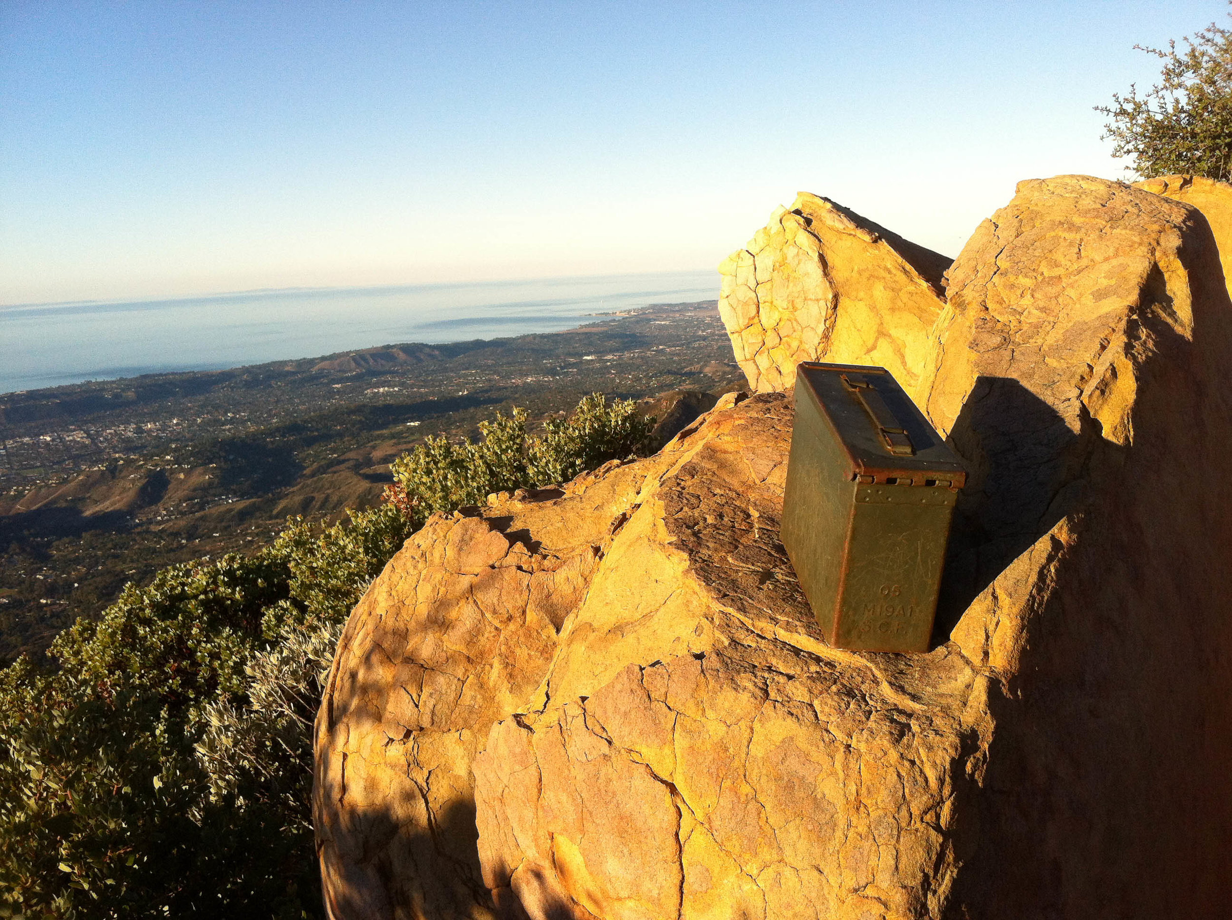
Summit Register at the top of Montecito Peak
I walked around the peak, found a small cairn on top and the benchmark. I also found a memorial to Albert Sakharov, a beloved local philanthropist that support the arts when the arts needed help. This was one of his favorite trails, and I could see why.

Benchmark at the top of Montecito Peak

Memorial at the top of Montecito Peak
Before long, I descended the peak, and reached the main trail, starting the short hike back up to the trail head. It was a beautiful start to a beautiful relationship that I will have with these mountains. Arriving home before 9AM, I was delighted to have the trail and peak, all to myself.

Looking north from the Camino Cielo
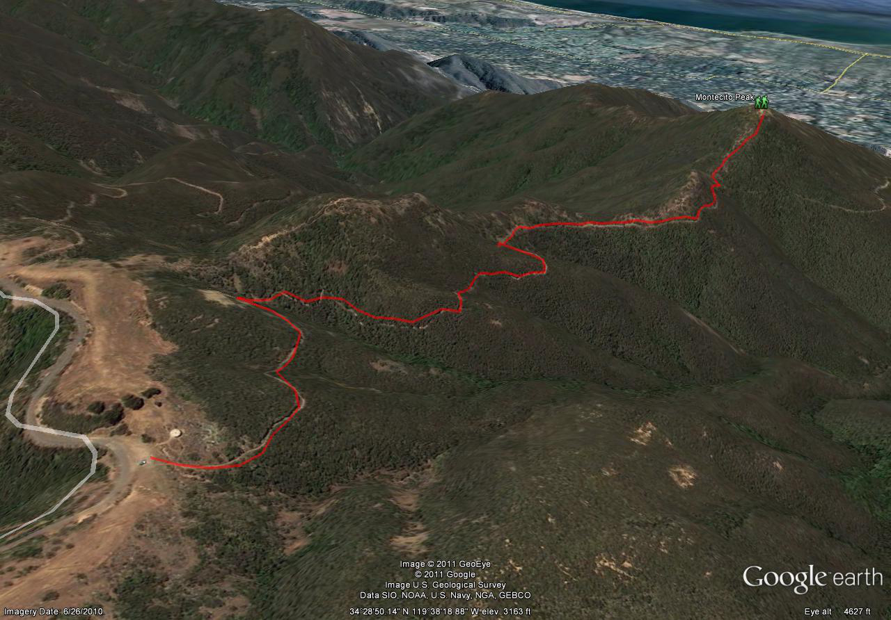
Montecito Peak Trail Map (Click to enlarge)
