Lockwood Peak - SB Peak #7 - An Interesting Encounter with a Prospector
Lockwood Peak
Elevation: 6,261′
Miles: ~6
Trailhead: Turnout off San Guillermo Road
Agency: Los Padres National Forest
Date Hiked: 06/02/2012
Peakbagger.com Page
For those interested, here is a list of my gear that I have found works well for me. This is, of course, an affiliate link and your enjoyment of these may vary:

San Guillermo Creek where it crosses Yellowjacket Trail
"A few years back, a bear surprised me in the canyon there, on the other side of that ridge. That was before I carried this," he said, patting his hip.
It was at this point that I noticed he had a revolver in a holster. His name was Ray, I think, and he had just sifted through 40 shovels of something and had ended up with a few flakes of gold in the pan he showed me.
It was also at this point that I wondered about the legality of carrying a sidearm and prospecting in Los Padres National Forest.
After a nearly two-hour drive, I had arrived at the trailhead. I was pretty excited at exploring the areas outside of the front range of Santa Barbara, but now I realized that was going to mean getting up earlier than ever before, or even perhaps sleeping near the trailheads. Los Padres National Forest is a vast place and the distance to some of these peaks are more than a reasonable person can achieve in a day.
I felt like I had passed a great number of different geologic zones on my way out there. I passed the spectacular Wheeler Gorge, Pine Mountain, and beautiful Lockwood Valley. These were new places for me and I was happy to be covering completely new ground.
When I got to the trailhead after some time on dirt roads, I saw a pickup truck with a trailer behind it. From the looks of it, with a chair and equipment strewn about it, it seemed like it had been there for some time.
I geared up and headed down the trail and immediately crossed San Guillermo Creek. It was green and there was plenty of water.
Before long, however, the trail completely dried out and I was in hot and dusty territory, surrounded by blackened trees with the occasional bed of blooming flowers. The Day Fire, one of the largest fires in California history, had burned nearly 6 years ago and this area was still recovering.

Bullet-riddled sign on the Yellowjacket Trail

Flower blooms along the Yellowjacket Trail
After my previous hikes on fire roads and bushwhacking, it was nice to be on an actual trail. It got pretty warm and my eyes and ears were careful for snakes, but from my experience, burn areas tend to be free of snakes for quite a while after the fire.
I started to see some meadow areas to my left and knew it was almost time to leave the glory of a maintained trail and start bushwhacking up a gully to the right. I scouted along the south side of the trail, looking for a cairn that I read was here. Not seeing it, I backed up until I saw it, further off the trail than I had anticipated. I headed past the cairn and immediately lost the faint use trail.

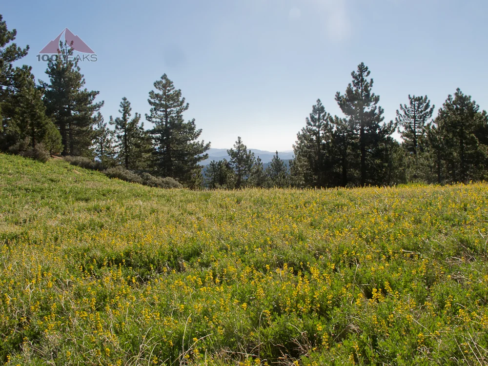
The meadow along the trail

The rock cairn showing the way up
I headed for the gully and I picked up the trail again, on the right side. An occasional cairn marked the way and let me know that I wasn't getting lost. Checking my iPhone's GPS helped, too. At this time, I started feeling the effects of the altitude. The gully got pretty steep, and at times, I was hiking on small scree fields. This was to be a training hike for my New Mexico trip to Wheeler Peak, so I was wheezing for a reason. I wasn't used to hiking at this elevation. At all.

The way up through the gully
I got to a cairn and passed it for a while and didn't see another one up ahead. I decided to climb the steep side of the gully to the northeast and start scrambling straight up. If I was to do it again, I would continue up the gully to the back side of the peak and approach from the south.
There are four humps in the area, but the one to the north is the highest. And that is where I found the summit register and an incredible view into the valley below. I was happy to be hiking, happy to have found the peak, and happy to have hiked over 6,000'. Anything I could do to prepare me for the 13,000'+ trip I had in a couple of weeks would be beneficial.

Lockwood Peak Benchmark

The view into Lockwood Valley from Lockwood Peak
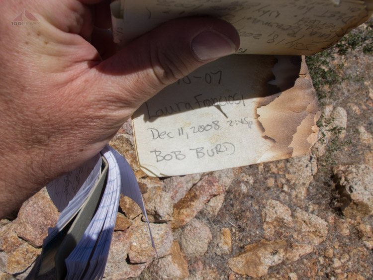
Bob Burd's signature survived the fire

Lockwood Peak Summit register and view
I signed the register and started heading back down, which I did much faster. On the way back, the heat of the day really ramped up. It was 92F, according to my car. I spotted some deer across the valley. During one rest break, I took off my sunglasses and blew hard on it to remove a persistent fly. That sharp sound startled a resting deer less than 50' away. This deer, leaping up from under a bush, startled me back.

The way back down from Lockwood Peak
I saw several other deer throughout the rest of my hike, which made me smile as I wiped the sweat from my brow. As I neared the trailhead, I noticed that the owner of the truck had returned, hunched over making a particular motion with his hands that corresponded with what I remembered about panning gold. I waved hello and he stopped and started talking to me.

Burnt trees along the hot trail
He had been panning for gold in that area for years and was impressed with the distance and elevation I had covered. We chatted a bit about our experiences and he gave me some tips about the area. He knew every creek and canyon by name. He said that bears and mountain lions used to patrol the area, but no so much any more.
We shook hands and parted ways. Los Padres National Forest was looking to be an interesting experience.
Lockwood Peak Trail Map (Click to enlarge)
Lockwood Peak Detail Trail Map (Click to enlarge)