


Peak 81 - Sombrero Peak - Savor the adventure
Sombrero Peak
Elevation: 4,229’
Mileage: ~3+
Trailhead: South Fork Indian Valley (End of wash)
Agency: Anza-Borrego Desert State Park
Date Hiked: 12/10/2020
Peakbagger.com Page
For those interested, here is a list of my gear that I have found works well for me. This is, of course, an affiliate link and your enjoyment of these may vary:
12/10/2020
It was to be my first time in the desert in a while. I had a plan to summit the remainder of the peaks on the San Diego 100 Peaks Challenge before the end of the year. I had them mapped out, calendared, and I was on a mission.
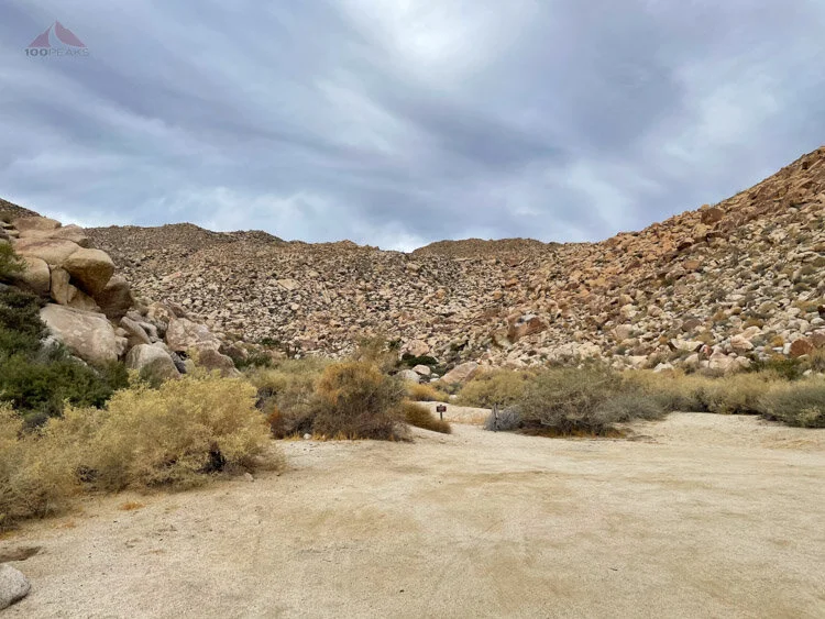
The start of the wash at the Sombrero Peak trailhead
For this day, we had three peaks on our list. Sombrero Peak, Red Hill, and Mine Peak. We met at my home in northern San Diego at 5:30AM, transferred some gear, and headed out. We stopped for some drive-through breakfast in Ramona and drove out to the desert.
We stopped at the Mountain Palms Springs Campground for a bio break and then drove in through Indian Gorge to Indian Valley, making the left turn at the road fork and continued through the forest of cholla to the southern end.

Looking out toward Indian Valley at the Sombrero Peak Trailhead
By the time the dust settled and we were ready to head up to the peak, it was already 8:30AM. I was concerned, with the short winter days, whether or not we’d have enough daylight to get all three peaks this day.
We headed west and southwest up the main wash, sinking into the sand here and there, with footprints all over. After zig-zagging a little bit, we could see the wide wash to our right (south), narrowing as it rose up. Sometimes these views can seem a little overwhelming.
You stretch your muscles at the base of a steep hill, knowing there are hills beyond this one, and there is no true way up. You have to find it on your own.

We turned left here, following the wash, sometimes in it, sometimes on the left
We scrambled up, here and there, looking for the path of least resistance.
That’s what off-trail desert hiking ends up being most of the time: finding the path of least resistance through boulders, cacti, yucca, agave, acacia, and gravel that flows downhill. All while keeping an eye on navigation and your end goal; a peak high above you.

Some use trails and cairns on the left side of the wash
Sometimes your mind plays tricks on you, seeing paths through the obstacles where none exist, Except that any path, even if it’s not a trail, means 20 or 30 feet of unimpeded movement. Sometimes that’s a win, except when it leads you to impassable brush and you have to backtrack.
Keeping mostly to the hiker’s left (east) side of the wash wasn’t too bad, occasionally dipping back down into the bottom of the wash until the upper reaches, when a use trail seemed to appear and we followed that to the sandy shoulder ahead, where the trail disappeared.

Getting closer to the second shoulder of Sombrero Peak
Checking the map, we then headed right, toward another shoulder in the distance. We were able to pick up a faint trail here and there as we went around north of a rocky knob and picked up a pretty good use trail leading up to the shoulder.

A beautiful desert morning
There, we took a little breather and saw a boulder with a cairn on top of it. I thought it was a trail marker until I came upon a water bottle next to it. It made me wonder what route would require this tiny cache.

Someone's water cache on Sombrero Peak's shoulder

The view out to the desert below
Scanning the rocky hillside above us, we spied a cairn here and there and made our way up, ultimately angling left (south) of the sub-peak. We encountered another flatter area, which seemed pretty nice for camping, if you’d like to haul your backpack full of water all the way up that hill.

The way up to Sombrero Peak
We cruised a little bit, picking up another use trail until it was time to climb the last bit of the mountain. We followed the use trail, losing it here and there, but, once it wasn’t as steep, it was actually pretty fun, navigating around the obstacles and hopping over rocks.
We came to a large boulder which required some scrambling, so I scouted around to the right through some bushes, but that was a dead end, and I should have believed the sticks across that path to block the way. I returned to the left, and we climbed a little bit, grabbing onto a tree branch to hoist ourselves up.
Next thing we knew, we were on the top of Sombrero Peak. We sat down in the sun and had a snack while taking some pictures.
Given the amount of bushes we had to pass through, I was glad to have worn my leather Keen boots, topped with my old-school almost knee-high gaiters.

Happy for my bomber gaiters for the cross-country scramble up and down Sombrero Peak
We relaxed for a while, enjoying the extensive views all around us. It was a very nice day in the desert. The sun was warming us under the high clouds. There’s something special about being atop a desert peak. The remoteness feels great and the visibility is excellent.
Panoramic View down into Indian Valley from Sombrero Peak

Looking northwest toward Monument Peak from Sombrero Peak

Looking east toward the windmills in McCain Valley from Sombrero Peak
The views were nice, but my mind was on the other two peaks. I was a little tired from the vigilance of cross-country desert navigating, but the other peaks were relatively short.

Something was chained up here on the sub-peak below Sombrero Peak
We headed down and made our way around the sub-peak. From there, we could see the original side wash straight below us to the northeast. I knew that other hikers had ascended and descended directly up and down the hillside, so we headed straight down. It turned out to be pretty treacherous, even with trekking poles.
The hillside was soft and unstable, and we lost our footing frequently. Rocks slid beneath our feet and tumbled down below us. We spread out so we didn’t bean each other with runaway boulders.
The way was slow going. We made our way to a rocky outcrop and realized that while this way was direct, it was really taxing our legs and our spirits. We angled to the right (east) and headed back toward our original path at the top of the wash.
We thankfully found the use trail and made our way down the wash, still either taking the eastern side of the wash too high or dropping into the bottom of the wash only to encounter large boulders or acacia bushes.

Where we should have descended Sombrero Peak, down and to the left
We finally made it to the last few hundred feet to the car and shook our heads at how challenging it was. Our detour near the top and the constant vigilance had worn us out. We ingested some calories and water and headed out to the next trailhead. The PD decided to stay behind with the car as I set off across the desert.

Where we should have descended, for sure
About ¾ of the way up to Red Hill, I hit a cliff band and erroneously thought I was on the wrong ridge, as the sun started to dip lower into the sky. I called it a day and went back to the car as the sun set.
I was weary with hours of steep cross-country desert travel. As the temperature dropped and I changed into sandals, I sat at the back of my car and reflected on my motivation.
I had placed artificial pressure on myself to try to squeeze these peaks at the tail end of a pandemic year while running a restaurant. It was arbitrary and could possibly get me into trouble, pushing myself faster than I should, forcing me to make rash decisions, like heading straight down that hillside. The shortest path is not always the best one. It almost never is.
The pressure to complete the peaks also reduced my present enjoyment of being out there in the desert, however challenging.
I should be savoring each step, listening to my feet crunch into the gravel, smelling the desert plants all around me. The silence when we were still should have been a constant companion.
I, then and there, decided to give myself forever to finish the peaks.
Some stress immediately lifted from my life. The plan for three peaks in a day would have been reasonable if I was able to get a good night’s sleep and not shoehorn them in between all of my responsibilities of the restaurant. But my reality was otherwise.
I got back behind the wheel and we congratulated ourselves on a successful summit of Sombrero Peak and headed home, enjoying the beauty along the way.
Maybe I could climb them all by the end of the winter.
Maybe not.
Either way.
Sombrero Peak Trail Map (Click to Enlarge)

