


Peak 88 - Red Hill - A desert scramble to volcanic lava rock
Red Hill
Elevation: 1,720’
Mileage: ~3
Trailhead: Turnout off Sweeny Pass Road
Agency: Anza-Borrego Desert State Park
Date Hiked: 12/10/2020
Peakbagger.com Page
For those interested, here is a list of my gear that I have found works well for me. This is, of course, an affiliate link and your enjoyment of these may vary:
12/10/2020
I had been a little bummed.
Exactly a week before, I had attempted to summit Red Hill, after scrambling up Sombrero Peak. I had encountered a rock outcrop that cliffed out a little and thought I had been on the wrong ridge.
Since I had downloaded the wrong track onto my phone, I had realized that I wasn’t as prepared as I had liked, and, since we were nearing the shortest day of the year, the sun would be setting very early.
I had made the decision to turn around and came to the conclusion that I will savor my remaining 100 Peaks, rather than hurry through them.
This time, I had the entire day to enjoy two peaks that were near each other. Both required some cross-country desert travel, but both were fairly short. The first was to be Red Hill and the second was Mine Peak. There would be some driving between the two peaks.
I started at the same dirt parking lot off the S2 from last time and headed across the desert. I remembered that it was easier to rise above the washes, as the dirt was firmer, once the opportunity presented itself.

Heading out across the desert, Red Hill in the distance
I had been here once before, 7 days ago, and I had researched the maps thoroughly. The area is seldom visited and I was only sharing it at the moment with the birds and rabbits.

Follow the wash to the left, don’t get too close to the hills to the right
Once I got to the large wash, it was disheartening to see motorcycle tracks in an area that was clearly closed to vehicles. Looks like they drove through the posts with a sign that reads “No Vehicles.”
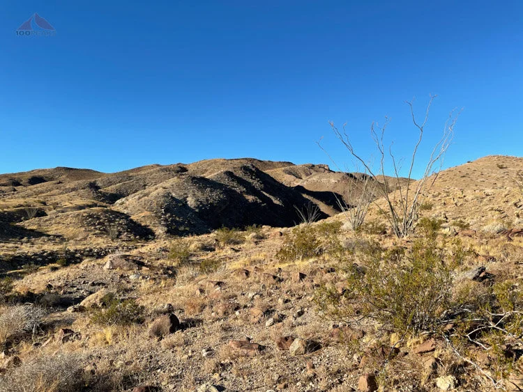
Approaching the large wash, the ridge to ascend is across
I then hiked up the wash, looking for a good spot to climb out of it. After a few hundred feet, I climbed out of it and began climbing the ridge that would ultimately ramp up to the peak.
Ascending the ridge out of the main wash
Looking back down to the large wash
It’s amazing how a lack of confidence and failing daylight can make an area seem very uninviting.
This time, I was prepared and the way was very straightforward.
Like many desert peakbagging hikes, there is not one true way to get to the summit. However, in my research, this seemed like the most straightforward.

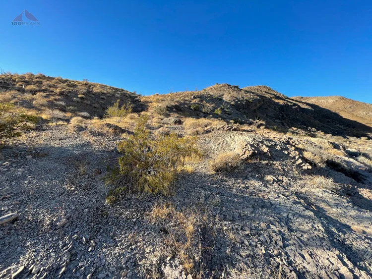
Ascending the ridge around the cliffs, following the ridge to the center right
I continued up the ridge, hiking around the cliff area the stifled me last time, and finding a use trail high up. I topped out onto the summit plateau and hiked across.

Following the faint use trail to the right into the small gully up to the outcrop above
I found the Red Hill summit register on the southern end of the summit plateau. I relaxed and had some food, enjoying the views. I took my time, knowing the way down would be fairly simple.

Red Hill Summit Register

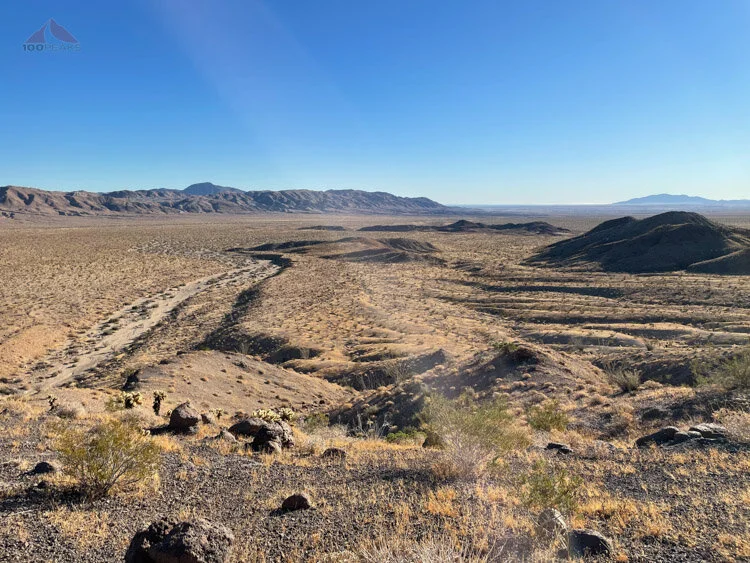
Looking northeast toward Mine Peak from Red Hill

Looking Southwest toward Volcanic Hills, Jacumba Mountain in the distance
Once again, I had a mountain to myself.
The sun was shining during a cool morning and the wind was reasonable. After I was done eating and relaxing, I headed back down, enjoying the moment, but also eager to see what Mine Peak looked like.
Red Hill Trail Map (Click to enlarge)

