


Miter Basin Backpacking 2023 - A Return to Paradise - Horseshoe Meadows to Miter Basin
Miter Basin
Elevation: 11,200’
Nights on Trail: 5 (Including the trailhead)
Miles: ~40
Trailhead: Cottonwood Lakes Trailhead
Agency: Inyo National Forest
Dates Hiked: August 5 to August 10, 2023
For those interested, here is a list of my gear that I have found works well for me. This is, of course, an affiliate link and your enjoyment of these may vary:
Introduction - A strong first impression
In 2010, the PD and I hiked through Miter Basin on a two-night trip to Mount Whitney, using a route described in Mount Whitney: The Complete Trailhead to Summit Guide by Paul Richins Jr.
That 2010 trip was my first backpacking trip in the Sierra Nevada since 1987 and the first time being back to Mount Whitney since 1984. It re-opened my eyes to the beauty and challenges of high-elevation backpacking.

The PD in Miter Basin in 2010
On our way to our second night, the PD and I moved through a landscape that has been etched in my mind ever since. This is even though our time through Miter Basin proper began at around 10:45 AM on July 9, 2010 and ended at around 12:45 PM at Sky Blue Lake (6 PM if you stop the clock at Crabtree Pass).
We spent only two hours hiking through the basin itself. However, with its rolling, grassy valley flanked by granite giants and beautiful Rock Creek flowing in its center, Miter Basin has been calling to me since we left it.
This time, in 2023, I was able to visit Miter Basin with several old friends, and make some new friends. It ended up being a reunion of sorts for Mile… Mile & a Half, and Noatak: Return to the Arctic.
It was a magical trip.
The Players

Adam Salinger
Adam (Dreamer) is a good friend that I’ve been on several trips with. He has started a backpacking coaching company, using his vast experience in the outdoors as well as 30 years of being a teacher, called Alpine Adventure Coaching. (Photo by Ric Serena)

Andrew “Tip” Taylor
A renowned nuclear medicine physician and ambitious outdoor adventurer, he’s been everywhere, man. I’ve backpacked with him several times and he was the subject of the lovely Noatak: Return to the Arctic.

Durand Trench
Production Sound Mixer and Sound Editor, he appeared in and recorded and mixed the sound for Mile… Mile, & a Half, and edited and mixed the sound for Noatak: Return to the Arctic, among others. (Photo by Ric Serena)

Paul Bessenbacher
PB to those that know him, he is a composer and the mastermind behind indie-pop band, Opus Orange. He was the composer for both Mile… Mile, & a Half and Noatak: Return to the Arctic. (Photo by Ric Serena)

Jason Fitzpatrick
A good friend from many of my adventures, most notably, The Wonderland Trail and The Teton Crest Trail. He is a Producer and Editor, known for Mile… Mile, & a Half and most recently, Free Outside: Chasing the Colorado Trail. (Photo by Ric Serena)

Ric Serena
Producer and Director, he is also known for both Mile… Mile, & a Half and Noatak: Return to the Arctic. His most recent work, Radio Silence, is gaining a lot of notice in the film festival circuit. (Photo by Ric Serena, obviously)
Day 1: San Diego to Cottonwood Lakes Campground
08/05/2023
In order to attend a celebration of life for someone dear to me, and to support her husband, my oldest friend that I’ve known since I was about 9 months old, I was to be in Orange County on the morning of our departure. I was a flood of emotions as I read the eulogy and emceed the event. It was great to see all of the friends and family sharing the love for the departed, but absolutely heartbreaking that it was necessary.
My backpacking friend, Tip, was able to meet me there and we were able to head out directly, though a little later than anticipated.
Tip and I enjoyed the route out of SoCal and up the 395. We both have a lot of stories, though to be fair, his yarns are way more interesting.
After some stops for food, we made it to Horseshoe Meadows in the dark. I reflected on the fact that this was my 4th time camping at this trailhead and the 9th time coming up here.
We made our introductions and quickly got our tents up and settled in by the fire. I tried to resist being a fanboy to Ric, Durand, and PB, since Sophia and I had been watching Mile, Mile, and a Half since we purchased (pre-ordered!) it on iTunes way back in 2013.
Sophia and I have watched Mile, Mile, and a Half many times over the years on planes and on our TV, enjoying the adventure and camaraderie. The documentary defined a generation of outdoor films to come. We have also been listening to Opus Orange for many years, especially as a tradition when working on puzzles.
We all got to know each other a little bit before it was time to hit our tents. It was chilly and I didn’t sleep very well, given the emotional intensity of the day.
Day 2: Cottonwood Lakes Campground to Long Lake - 6.2 Miles - 1,456’ Gain
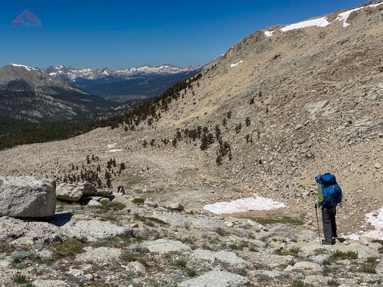
We woke up a little late, since we didn’t have that far to go and enjoyed our time in the morning sunshine. We headed out on the trail at around 9:30 AM. Tip was having some elevation issues, so we all grabbed some items from his pack and took our time along the trail, having many breaks along the way.
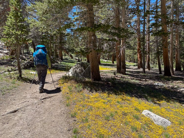
Tip heading up to the Cottonwood Lakes Basin
Everyone was in a good mood. Ric and Durand had been busy working and raising kids over the past few years and we were all excited to be there. There was a contagious joy that was a combination of appreciation of the outdoors and the thrill of meeting people we’ve been wanting to meet for a while.
We made our way through the lower trail along Cottonwood Creek and ascended the final climb to Cottonwood Lakes Basin. I’ve always enjoyed the wide open views of the meadows and Cottonwood Lakes 1 and 2, with Mount Langley towering above everything.
Topping out into the Cottonwood Lakes Basin (Click to Enlarge)
We skirted the lakes and crossed the large avalanche field, and before we knew it, were along Long Lake. I’ve passed this lake four other times, but have never camped alongside it. Tonight would be different.

Tip and our large campsite at the west end of Long Lake
We selected our spots, six tents for six people. We all fit just fine. As I was filtering water and having a snack, I heard some yelps near the lake. A few of the group had gone into Long Lake for a dip. I wasn’t going to miss this.

The creek above Long Lake, where we got our water
I hurriedly grabbed my towel and headed along the lake to a shallow entry spot near a large rock. They had appeared to all have already gone in and were drying off. Without hesitation, I walked out to the other side of the boulder and took a nice plunge into the cold water. It wasn’t as cold as other lakes, but it did take my breath away. I headed back to the shore and dried off. Always go into the lake. I was completely refreshed.
Taking a dip into Long Lake (Photo by Ric Serena)
We headed back to the campsite in great spirits, hanging our clothes in the trees.
We had dinner in the fading light as the mosquitos woke up in force, while we lifted our headnets to eat. We shared meaningful stories, including the intense grief I was feeling, until it was time to turn in. I was grateful for meeting some new friends.
I slept great.
Day 3: Long Lake to Miter Basin - ~8 Miles - ~2,000’ Gain
We woke up at 6AM, everyone eager to get on the trail. Tip, concerned about his speed, was the first to get on the trail so we wouldn’t have to wait for him. He said he felt a lot better than the day before.
PB let us know that he would be returning to the trailhead today, but he would be day-hiking up to the top of New Army Pass.

Ric heading up to New Army Pass

High Lake
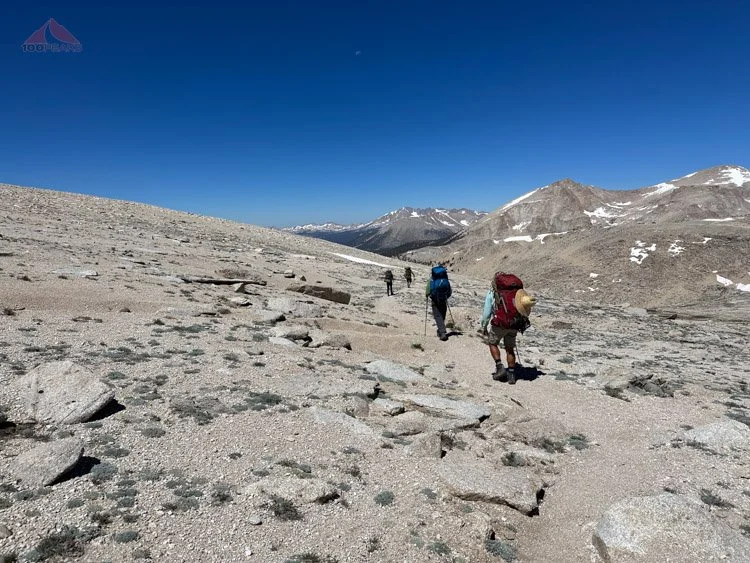
We all headed out, eager for the climb and the views beyond. The weather was perfect. I looked up at New Army Pass and it was hard to tell where it was, as there were several cornices along the ridge. We’d figure it out once we got there.

Bog crossing below New Army Pass
First snow crossing on the way to New Army Pass
After circumventing a large snowfield below Long Lake, we crossed a wide creek or bog before starting the long switchbacks below the pass.
We switched back and forth, getting a good rhythm going, occasionally crossing a snow field. We had to scramble up a loose slope to avoid a very large field of snow.

The rock scramble to avoid the cornice at the top of New Army Pass
When we approached the top of the pass, we had to climb a few boulders with some exposure. We had to get around the cornice and some sketchy patches of snow. It was a little challenging squeezing through some rocks with our large packs on, but it was fun and before we knew it, we were at the top of New Army Pass.
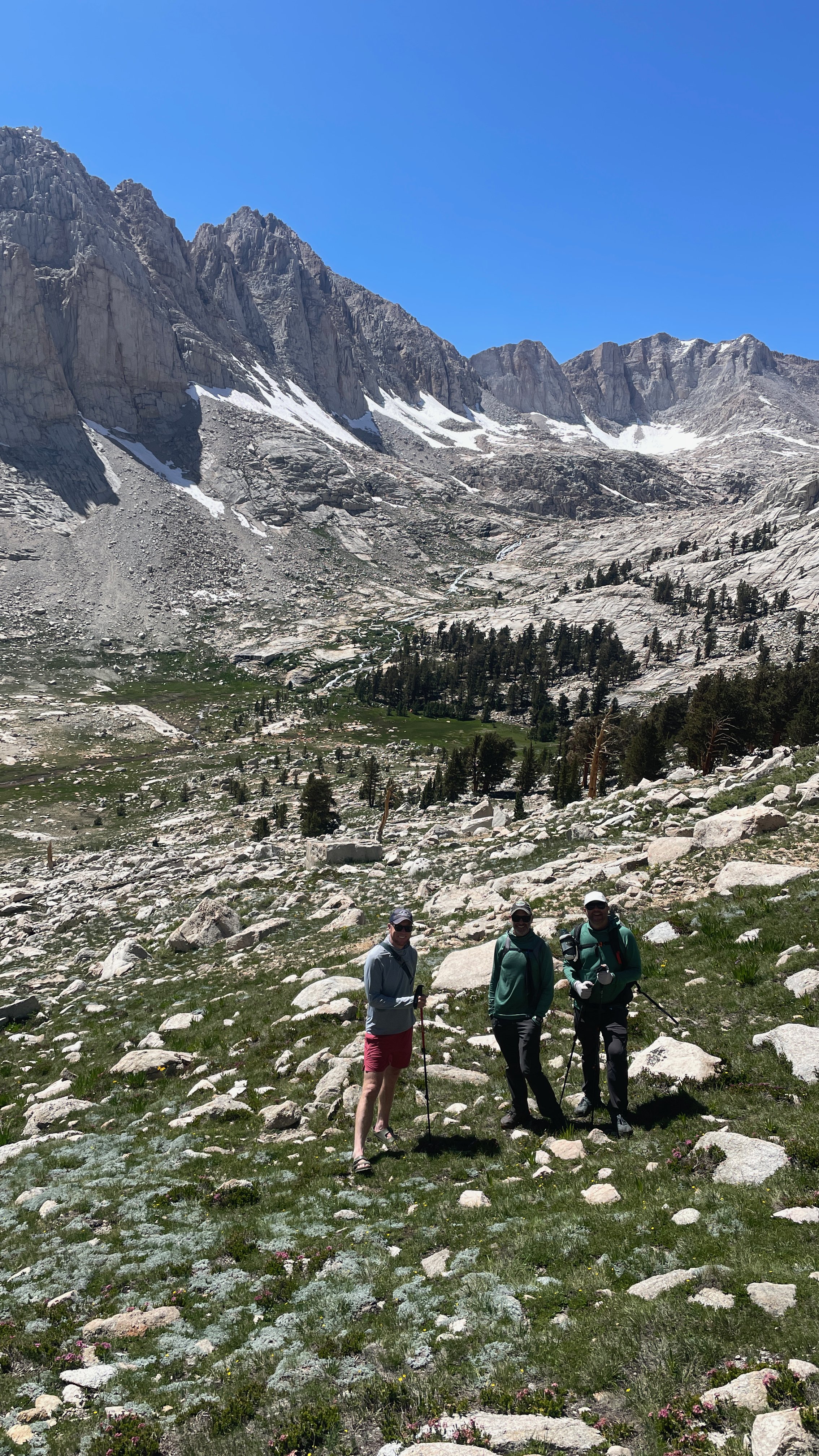
The crew atop New Army Pass - Adam was on the way (Photo by Ric Serena)
Mount Langley from the top of New Army Pass (Click to Enlarge)
Tip was very strong while climbing. He was back to 100% and showed no signs of the AMS that he was feeling the day before. I only caught up to him as he was climbing some rocks to the top of the pass.
We had a nice long snack, along with making each other laugh, as we looked out over the expansive views of Mount Langley and the mountains beyond. Reluctantly, we said goodbye to PB, as he headed back down the pass to collect his things at Long Lake. It was a pleasure to have been able to meet him.
We kept an eye out behind us, as Adam was to meet us along the trail sometime today.
Heading down New Army Pass
We headed down the other side of New Army Pass and enjoyed the easy downhill trail with views all the way west to the Great Western Divide.
Tip descending
We took a break in an alpine valley next to a flowing creek. It was simply gorgeous. We sprawled among the boulders sharing stories and having snacks. We refilled our water bottles and headed down the valley, encountering grass and flowers, then entering the forest.

Tip and crew with Mount Anna Mills above and the Great Western Divide in the distance

Almost to the Upper Rock Creek Trail
We had dropped about 1,400’ and had traveled through so many zones. We stopped at the trail junction. We made a right at the Upper Rock Creek Trail, chatting with a pack station outfitter who was on her way out over Cottonwood Pass. We made another right on the Soldier Lake Trail.
Some of the group went ahead while Tip soaked his bandana in a creek. We crossed the outlet creek to the west side of the lake, following the route the PD and I had taken in 2010.
However, the rest of the group ended up continuing north on the east side of the lake. Our way up, which I call Soldier Pass, was on the northwest corner of the lake. I called over and they met us back on the western side and we stopped for a snack before the quick steep climb to the slabs above Rock Creek.
I have since researched and there is another use trail on the northeastern side of the lake that might keep you higher for longer and may ultimately be a great way to make it into Miter Basin. I might try it next time.

Climbing up Soldier Pass and looking back to Soldier Lake
After some huffing and puffing up the loose trail, we scouted the slabs to the northwest. And once again, like I did in 2010, I descended too early down into the Rock Creek drainage, leading the crew behind me. We followed some cairns which led us downward toward the roaring creek below. I kept traveling north, but ultimately, we dropped down into the basin just past a seemingly impassable gorge. I know there is a trail along Rock Creek all the way from near Rock Creek Lake, but I imagine it might be marshy and have to climb high above the cliffs of the gorge.

The Slabs along lower Miter Basin - keep even more right of this (Photo by Ric Serena)

Our cross-country section of Lower Miter Basin
We scrambled down some slabs to the soft grass and headed north toward Miter Basin. We crossed Rock Creek on some boulders and followed an easy use trail on the west side of the creek. The trail then ascended high into the rocks to the left and zig zagged around some creeks. I was getting flashbacks from 2010 as the PD and I lost the trail a few times at this exact spot. The same happened on this day.

Navigating the beautiful middle part of Miter Basin
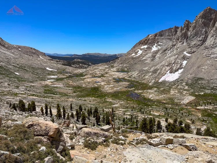
Middle Miter Basin is very stunning and would make a great spot to camp with its rust-colored granite slabs and flowing water, but we were aiming for the main part of the basin. We headed back east over the creek and finally met what appeared to be the main trail.

Almost to the proper trail in Miter Basin

Reunited with Adam in Miter Basin - our campsite will be in the trees up to the left
And there was Adam. He had finally caught up with us, after hiking about 20 miles. There had been a miscommunication and he had ended up hiking many extra miles. But all's well that ends well and we began our quick hike along the basin floor toward our destination: The grove of foxtail pines just below the numerous cascades that came from Sky Blue Lake.
Due to the massive amount of precipitation this year (2022-2023), the basin floor was full of roaring creeks and marshy in the lower portions. I knew I’d be able to dry my shoes and socks quickly, so I walked directly through the creeks, which was a nice relief on my feet.

The view down into Miter Basin
We settled into the campsite. I, for some reason, allowed everyone to pick out their sites, so I ended up with a very slanted site, which I thought was going to be OK.
It was great to have Adam meet Tip, as well as the rest of the crew. Adam and Jason go back a ways, but everyone else was new for Adam and me. We set up our tents, filtered water, and made our dinners, all the while getting to know each other. It was the largest group I’ve backpacked with in a while, but it was instantly apparent that we were all kindred spirits of the best kind.
Our campsite in Miter Basin (Photo by Ric Serena)
We all glowed from just being there and all agreed that Miter Basin was a special place. We shared laughter and awe. The alpenglow hit the peaks high above us and we went to bed early. We were tired.
Day 4: Miter Basin ‘Zero Day 1’ - 4 miles, 1,200’ of gain
While we called it a zero day, there was nothing zero about it. We woke up and had breakfast in the grass.
I did not have a great sleep. I slid downhill the entire night. I woke up with a headache, undoubtedly as a result of holding myself in place all night with my core and neck muscles. My pillow would slide off of my pad the moment I raised my head.
I scanned around for another place for my tent and found a spot far up the hill in the pines that looked very flat. I picked up my tent with much of my stuff still in it and carried it up the hill, carefully avoiding the grabby branches.

We crossed Rock Creek and ascended on the left side up to Sky Blue Lake
We decided to hike up to Sky Blue Lake to explore. I remembered the trail was on the west side of Rock Creek and we crossed and quickly made our way steeply up next to the cascades.

Tip with Miter Basin below him
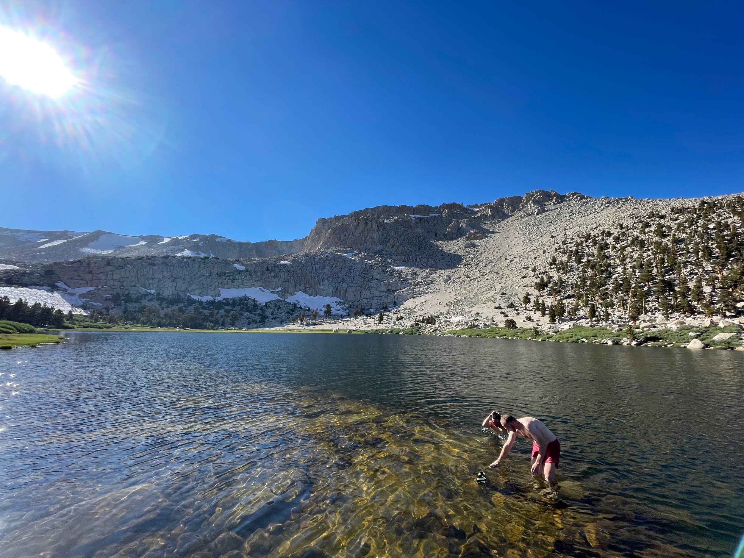
Before long, we were along the lake, and found some backpackers camped spaced out along its shore. While Tip sat in a small meadow with flowers and his journal, the rest of us made it to a large slab on the northeastern side of the lake. It was warm enough for a dip, so that’s exactly what we did.
Side note: The rock we ended up lounging on before and after our swim in Sky Blue Lake is visible in the panoramic photo on my home office wall (see below). I didn’t realize it until I returned home.
Sky Blue Lake pano from 2010 - our 2023 swimming rock on the right (Click to Enlarge)
Sky Blue Lake (Click to Enlarge)

Tarn near Sky Blue Lake
Durand goes for a swim in Sky Blue Lake (Photo by Ric Serena)
We sat in the sun on the large slab and had a nice snack, cracking each other up with stories and jokes. Even though I had just met Durand and Ric, I felt like I had known them forever. Perhaps it was seeing them in Mile, Mile, and a Half or perhaps we saw the outdoors similarly.
Dried from the sun, we got our outer clothes back on and some of us wanted to see Iridescent Lake, so we explored just below the first cascades of Sky Blue Lake and found some granite shelves that led us across the side of the basin to a steep chute. We climbed through the rocks and bushes, gasping a little bit due to the elevation and ascended to the first tier of the drainage.
Deciding the best way down to the slabs to Iridescent Lake (Photo by Ric Serena)
Miter Basin from the ledge
Yours truly climbing up the steep shortcut to Iridescent Lake (Photo by Ric Serena)
Iridescent Lake was still a ways off. After the steep climb, we still had about ⅔ of a mile to go with some gain. I think the past few hours of hiking along with the climb had used all of my calories, so I took my time getting up to the lake.
Tarn below Iridescent Lake (Click to Enlarge)
We passed through grassy bogs, ice fields, rocky moraine, and a flowery meadow underneath the lake’s outlet waterfall. It was stunning.

Flowers below Iridescent Lake
Again we relaxed by a gorgeous alpine lake, but this time it was a little chilly and breezy for a dip, so we lounged on warm granite and I shared my lunch of salami, cheese, and crackers. Our mood was high. We were all just elated to be here.
Iridescent Lake (Click to Enlarge)
We marveled at the steep walls of the bowl that held Iridescent Lake and wondered what it would be like to camp up here. Reluctantly, we descended back into the basin, following the outlet creek on the way down.

The wonderful landscape below Iridescent Lake
Heading down below Iridescent Lake (Photo by Ric Serena)
We rounded a corner and dropped to some boulders that offered a wonderful view of Miter Basin. We sat for quite a while, nearly 45 minutes, talking about family and parenthood and just absorbing the view.
Miter Basin from our rest spot (Click to Enlarge)
Headed back down to camp (Photo by Ric Serena)

Red creek in Miter Basin
We descended back to camp and relaxed in the shade of the trees until dinner time. We then grabbed our gear and headed over the granite slabs next to the cascades and had a wonderful dinner, serenaded by waterfalls, kept company by the views of the shiny creeks of Miter Basin below.

Relaxing at camp in Miter Basin

Dinner by the falls in Miter Basin

Our view from the dinner rock
Day 5: Miter Basin ‘Zero Day 2’ - 4 miles, 1,200’ of gain
In my new campsite, higher in the trees, I slept great. It was perfectly flat and I was comfortable and warm. I got up and everyone had breakfast in the grass near the small creek.
I found a marmot den surrounded by trash. My guess is that this marmot had been stealing things out of people’s packs and tents, or even on the ground, when people weren't looking, for a season or two.
I collected a nice pile of things, including reaching halfway into the den to remove some dehydrated meal bags. It was quite the haul. It fit into my bear canister now that I had eaten several days’ worth of food.
At 9:30AM most of us decided to venture out to Miter Basin to explore Primrose Lake and the tarn below it. We hiked along the western side of the basin, enjoying the easy stroll on the slabs. The clouds started to arrive, signaling that weather was on its way.

A morning trek to Primrose Lake across Miter Basin

Traversing the basin

Looking back down to Miter Basin with The Miter above

The tarn along the way to Primrose Lake

Ric getting the shot at the tarn
Climbing above the tarn, we passed some dead foxtail pines and scrambled up the pretty slope to Primrose Lake.

Dead foxtail pines along the way to Primrose Lake
I was a little gassed. Perhaps my meals were too small, or I didn’t train enough, or the elevation was getting to me. Or all of the above. I would hike until my heart rate would spike and then I’d stop and enjoy wherever I was.


We passed several rushing outlet creeks, each with their own cascades. There were flowers: yellow, purple, and white blooming out of the vivid green grass. The view out over the basin was amazing. I didn’t mind taking my time and being there.
By the time I got to the level of Primrose Lake, Adam was already standing on a floating ice sheet and jumping into the water to swim back to shore.
Adam on the ice on Primrose Lake (Photo by Ric Serena)
Primrose Lake (Click to Enlarge)
I made my way to the shore. I was ready for a dip in the lake, but the icy wind came up and I stood there shivering, waiting for a lull in the breeze.
The wind died for a second. I got into the water, instantly feeling refreshed. I dried off and felt my body hum with the cold. I leaned against the leeward side of a warm boulder, feeling the warmth of the sun.
We made each other laugh and fell into an easy banter. Like we had all been friends for years. Some of us had been friends for a long time, but again, as a group, even though we had just met two days prior, we just clicked.

Heading back down from Primrose Lake
We made our way back down to the campsite and had some lunch. Most of the group decided to go back to Iridescent Lake, as Tip hadn’t visited it the day before. Since I was lagging a little bit, I decided to stay back with Jason.

Jason at camp
We relaxed at the campsite, soaking in the view. We chatted about anything and everything. We saw a bald eagle soar across the basin. A group of backpackers arrived and set up camp on a slab high above us, but one set up their tent closer to mine than I would have thought manners dictated. It was no bother; I would only be up there to sleep.

Wandering through Miter Basin

The water felt good on my feet
I was ready to stretch my legs and was in an exploratory, introspective mood, so I wandered out into the basin. I crossed creeks and walked on granite slabs. I got to a wide, shallow brook and could not find a way across, so I took off my shoes and waded to the center of it. My feet sank into the soft, coarse sand. I followed the brook for a while, flanked by green grass. I walked barefoot on the grass and crossed several more brooks.
Green Miter Basin - lovely for a barefoot walk (Click to Enlarge)
My feet tingled wonderfully after being in the water. I strolled up the Iridescent Lake outlet creek, sat on a boulder, and soaked my feet some more. After strolling around and soaking my feet in several creeks, I put my shoes back on amid the roar of cascades. I sat and watched a hummingbird moth feed on pink flowers. I watched a dark rust-colored creek flow by.

A scenic foot soak

Hummingbird Moth
I spent an hour just being there on my own, strolling slowly around the basin. Not going very far, but examining everything around me. Soaking my feet. Watching the flow of water. Wondering why many large boulders appeared to be supported by smaller rocks underneath them. Wondering how long it would be until the boggy portions of the basin would dry out. I watched marmots chase each other. I wondered why we hadn’t seen any deer.
I made my way back to camp and listened to the group’s description of their trip up to Iridescent Lake.
Miter Basin Pano (Click to Enlarge)
Then it was time for dinner. The sun went down quickly, as the lofty shoulder of Mount Pickering rose a thousand feet above us. The actual summit of the mountain was another thousand feet further above its shoulder. The last direct sunlight we would see was at 5:20PM, when the temperature dropped drastically.
Tip and Adam chatting at camp (Photo by Ric Serena)
We grabbed our dinner supplies, which included chairs, stoves, and food, and hiked over to the same large granite slabs next to the falls.
We got to making our individual meals while laughing and sharing what we brought. A common theme of this trip was a shared happiness of just being there and an overwhelming feeling of gratitude.

Having dinner in Miter Basin (Photo by Ric Serena)
We knew this was our last night, so we savored it. Just as night was about to fall, most of the group decided to go back to the tarn below Primrose Lake. Jason aimed to get some nice photos in the evening light.
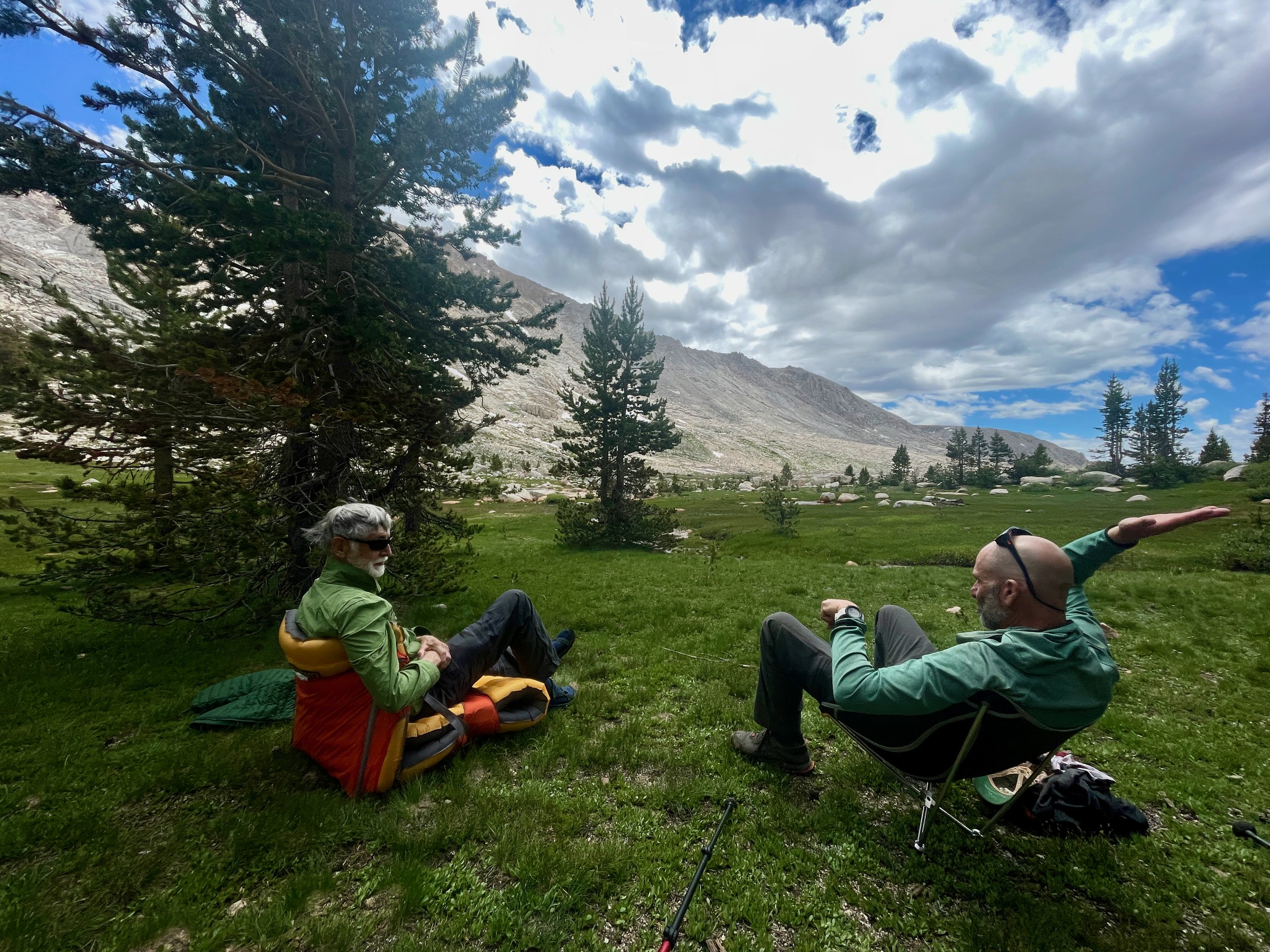
I decided to stay back with Tip, to share the dusk with him. We chatted for a couple of hours about the places we’ve been. As we gazed at the granite giants around us, bathed in alpenglow, we both agreed that we wished we knew more about geology.
We discussed many things until the rest of the group came back. It was getting cold, so we stashed our bear canisters and headed for bed.

The lovely brook by our campsite
Day 6: Miter Basin to Cottonwood Lakes Trailhead - 13 miles, 1,800’ of gain
We woke up early. We had been discussing our plans. We had built one more night into our itinerary, mainly to break up our last day. But the incoming weather and the fact that any campsite on the way out would not be able to compete with Miter Basin made us think about making all the way out to the trailhead today.
On pack-up days, I have a system where I don’t leave my tent until everything is packed up inside of it. Within 20 minutes, I had everything, including my tent, packed up into my backpack and brought it back down the hill to the group.
I looked around and all the other tents were still up. I was happy to have a head start. We had another breakfast on the grass in the rising sun. It was a beautiful morning, but it was clear the clouds were on their way.

Heading out of Miter Basin (Photo by Ric Serena)
We all finished packing up and by 7:40, we were ready to hit the trail. We aimed to the west, crossing the creeks, and skirting a large pond. The water was still and offered great reflections in the morning light under the clouds. It was an easy stroll on the basin floor and we were able to see the lower portion in a new light.

Crew reflection
Miter Basin is full of little pockets of beauty. One could stay here a week and have a lot of fun exploring its mysteries.

Headed down Miter Basin

Approaching Elizabeth's Pond, as an author named it
Instead of following Rock Creek southwest back the way we came, we followed Adam up some slabs on the eastern rim on the basin. We traversed due south on an easy off-trail route aiming directly toward Soldier Lake. We crossed a small ravine and continued upward. We had to route around a few trees, but it was the best way in and out of Miter Basin that I’ve seen.
It strengthened my urge to explore more off-trail Sierra high country.

Enjoying the easy path above Rock Creek back to Soldier Lake
An easy climb along granite slabs above Miter Basin (Photo by Ric Serena)
As I was stopping to take pictures, I checked the map and noticed the group was going high to the south, while the pass down to the lake was a little more southwest. I followed an easy route between two knobs and found myself watching a mountain grouse and her chick. The hen sat still in front of me so that the chick could hide.

A nice view from my perch above Solder Lake
Just beyond, I found a large slab overlooking Soldier Lake. Soldier Pass was just to the right of me, so I stood there, enjoying the view below and waited for the team to realize they were too far to the east. Sure enough, within a minute or two, they came down and we took some slabs down to the pass, which was way better than the steep loose scramble we had done a few days prior.

Coming back down the very steep Soldier Pass
We made our way down to the lake and said our goodbyes. Now that we were on established trails, the rest of the group would sprint to the finish line, while Tip and I would take an easy pace back to the car. There was a possibility we would stay one final night at Chicken Spring Lake, depending on our energy level and the rain.
Tip and I made our way back on the trail. The sky sprinkled on us throughout the day. It was an easy climb around the Cottonwood Cirque to Cottonwood Pass. We encountered a lot of people starting the John Muir Trail from Horseshoe Meadows. I am always amazed by people with no hat or sunglasses. Everyone was so fresh and enthusiastic about their upcoming adventures.
We decided we felt good enough to make it all the way out to the car and the weather wasn’t getting any better.

Crossing a meadow on the way to Cottonwood Pass
We stopped for snacks here and there, taking our time while the sky occasionally sprinkled on us. The weather was cool and the breeze kept the mosquitos off for the most part. We made it to Chicken Spring Lake, where we both shared memories of our time here.
Approaching Chicken Spring Lake (Click to Enlarge)
We made it down to Cottonwood Pass and continued on the sandy trail back down to Horseshoe Meadow.

Tip dropping down toward Horseshoe Meadows
I had forgotten just how sandy of a slog this trail was. While the last section is flat, it is like walking on the beach for miles under a heavy pack, after you’ve already hiked 11 miles. We trudged along until we saw the junction to head toward our trailhead and began the climb up and over a hill to the next campground.

Crossing the last creek before Horseshoe Meadows
We made it back to the car and got cleaned up. It was a long drive home, but we stopped in town for a nice dinner first.
I don’t know how many times I’ve driven the 395, but it’s like an old friend. We had to take a detour on the northern side of the San Gabriel Mountains. It was tempting to stop at one of the many late night food trucks on the corners. It smelled delicious as we drove by.
Tip and I can talk forever, and we did, getting home at around 1AM. His wife thanked me for bringing him home safely. I didn’t do anything; Tip is a strong backpacker.
Final Thoughts
There’s something special about Miter Basin. Although it’s visited a lot more than it used to be, there’s something about the granite giants, the green grass, the rust-color rocks, and meandering brooks that just calls to me.
Sharing it with this group of friends, new and old, made it all the more special.
And although there are so many other places I’d like to go, I know I will be back. Perhaps with Sophia next time.

