Backpacking Cougar Canyon - Finding Water in the Desert
Cougar Canyon
Mileage: 2-8 (depending on where you start)
Trailheads: Coyote Canyon Second Crossing, or Cougar Canyon Trailhead
Agency: Anza-Borrego Desert State Park
Dates Hiked: Jan 7-9, 2022, Jan 29-30, 2022, Nov 5-6, 2022
For those interested, here is a list of my gear that I have found works well for me. This is, of course, an affiliate link and your enjoyment of these may vary:
Coyote Canyon is a large swath of desert in Anza Borrego Desert State Park. A lot of off-road enthusiasts visit the area when the creek crossings allow it. However, if you veer your hike off the roads onto the trails or cross-country routes, you can find some solitude and beauty.
I visited Cougar Canyon twice this winter. It’s a beautiful corner of the park accessible from the massive Coyote Canyon. The first visit was so fun with Jason and Dreamer, I had to come back a couple of weeks later with my daughter, the PD, and his daughter.
I visited again in the autumn with another friend. The water was gone, but it was a still a beautiful experience.
Update 2023: Adam (Dreamer) has since started a backpacking training company, using his vast experience in the outdoors as well as 30 years of being a teacher, called Alpine Adventure Coaching.
03/25/2026 Current Thoughts
In August of 2023, Tropical Storm Hilary brought a ton of moisture into the area. Hilary broke records in four U.S. states for wettest tropical cyclone or its remnants. The torrent washed out portions of Coyote Canyon Road leading into Coyote Canyon. Anza-Borrego Desert State Park close Coyote Canyon from vehicle entry as a result. It remains closed to vehicles as of this post with no timeline for opening.
Although many people have been clamoring for the park to reopen this area for motor vehicles, I fear that the behavior of the few has caused the many to not be able to drive into it anymore.
I visited the area three times in 2022, driving over Boulder Alley the second time without an issue in a Lexus SUV (Land Cruiser). On my third attempt, Boulder Alley had already eroded to the point that I didn't want to drive it with my RAV4.
On my way in before a wonderful night backpacking, I saw that a large group of off-roaders had driven off the dirt road, with tire tracks all over the sand, leading off into the desert. They had built a huge bonfire right on the Coyote Canyon desert floor. Sheep Canyon Campground was mere minutes up the road, and other well-used, impacted areas were available throughout Coyote Canyon.
This group chose to impact a brand new area for reasons that are beyond me. I am certain they broke other rules along the way.
Again, the poor behavior of the few affects the access of many.
This is purely speculation, but the reality of this area is:
It's hard to patrol and enforce the rules
It is sensitive culturally, historically, and naturally (animal access to water).
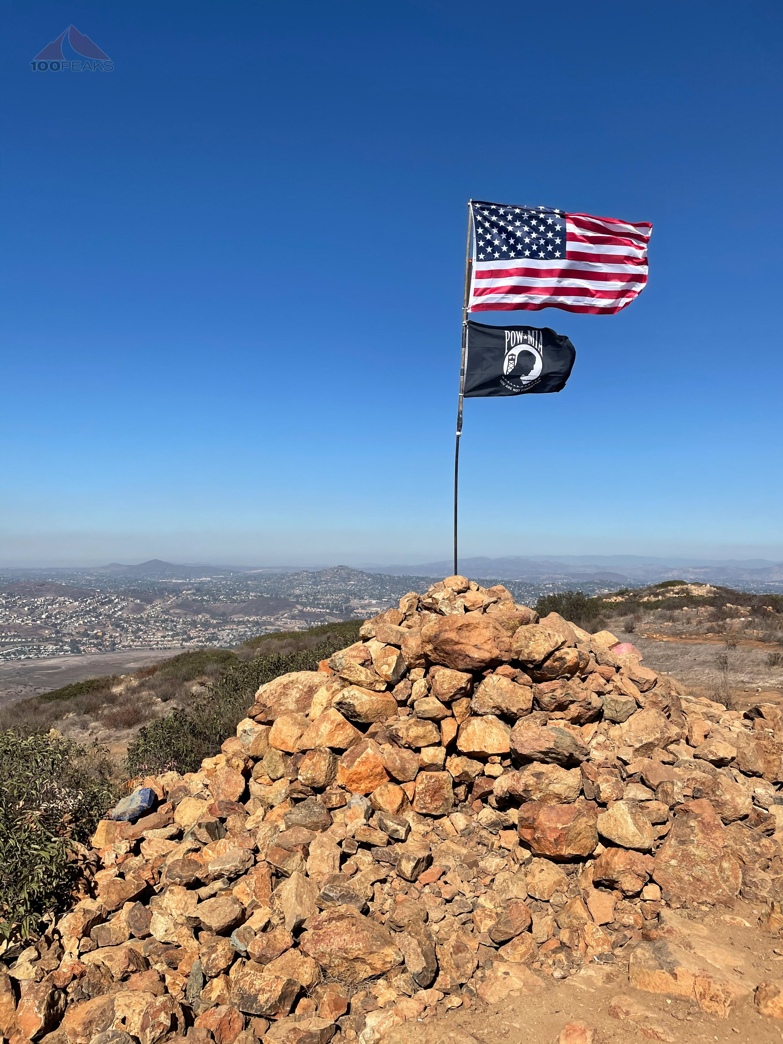
It's now considered a Cultural Preserve, and I theorize that the park would like to change how it will be accessed in the future, regardless of how it's been historically accessed. The preserve is less than 1.4% of the park. As a backpacker, I feel the rest of the park has many more roads to explore and kudos to ABDSP for saving this little corner.
If they ever do open it up for vehicles, the rules are clear: Car camping only in designated campsites or already impacted areas within the preserves, and wild camping (backpacking) with the same rules as the rest of the park. They officially only closed a few spur roads.
Reducing car traffic to cultural resources was the goal of the plan and that seems like sound reasoning to me.
Visit 1 - Jan 7-9, 2022
On the first visit, it was a sunny but chilly morning as we drove the hours out of San Diego, through Ramona and past Ranchita to zig-zag down onto the desert floor.

Visiting the Yeti at the Montezuma Valley Market (now Ranchita Bodega) in Ranchita
It’s always a great drive and I was able to visit the Montezuma Valley Market (now called the Ranchita Bodega) and chat with one of the owners, Mike, who was in the process of getting the store back open in a reasonable way after a tragic fire that burnt the place to the ground. Mike and Kemi have been knee-deep in bureaucracy trying to get the place rebuilt.
At the time of this writing (May 2022), they’ve been able to open a temporary version of their larger vision and are fully serving the Ranchita community, as well as PCT thru-hikers. They have a lot of hiker supplies, a great selection of beer, as well as local goods. I highly recommend stopping by to say hello on your way in or out of the desert. Try the products made from local honey, made nearby.
We made it to Coyote Canyon Road, where in 2019, Jason and I spent the day driving through a stormy desert, finding flowers blooming all over.
To get to Coyote Canyon, there are three crossings of Coyote Creek, the second of which is usually the deepest. We made it to the second crossing and I pulled my AWD SUV over into a parking area to take a look. I have fairly decent clearance, but it appeared to be a little too deep for my comfort.
We decided to hike from there. As we were getting out our gear, a Jeep drove dipped down into the creek to cross, the creek’s water up to its doors. I had made the right call.
As I was completing my prep, which included putting on sunscreen and strapping stuff onto my backpack, I realized that I had left my hiking shoes on the floor of the garage, right next to where I loaded my car.
I checked and rechecked my car. I did not have hiking shoes.
What I did have were some Patagonia corduroy slippers which I’ve been wearing for over a decade. I made the call to wear those for our three day adventure into the desert backcountry.
The teasing commenced.
We found a way across the creek without getting our feet wet and hiked up the sandy dirt road. I had brought some creature comforts, since this was a relatively flat trail and not too far, so my backpack was a little heavier than normal.
Luckily, we didn’t need to pack a ton of water, since, from all research, Cougar Canyon Creek flowed year-round and would be flowing nicely in January.
Update: Cougar Canyon Creek does not necessarily flow year-round, as I found out in November 2022
We chatted while hiking the rocky and sandy dirt road, occasionally stepping aside to allow a 4X4 vehicle to pass.

Navigating through the Third Crossing
We easily crossed the third crossing and made our way up Boulder Alley, a now-reasonable climb up a hill that bypasses the sensitive Lower Willows area.
Because the Lower Willows area changes from year to year based on the path of water, a bypass was built that went over a hill. It was also a sensitive wildlife and plant area that was getting heavy use from off-road vehicles.

Hiking on Coyote Canyon Road
In the past, it was filled with huge rocks that only the most capable off-road vehicles could pass. As a result, it was named Boulder Alley. It has since been reworked so cars with reasonable clearance can make the trek.
As we hiked up and over, it became evident that, as long as my SUV could make the water crossings, it could easily make it over Boulder Alley.
The three of us descended the other side, visiting the Santa Catarina Spring area, named by Captain Anza, the namesake of Anza-Borrego. It was hard to imagine his huge group of 240 people and 800 cattle coming through here in 1775.
We followed the sandy road until we found a hiking trail leading to the west, eliminating a section of road walking. It was really soft sand, so we discussed opting for the road on the way back.

Looking to Sheep Canyon
We connected with the road again and passed Sheep Canyon Campground, where there were a couple of cars camping, and made it to the Cougar Canyon Trailhead. A couple of cars were parked there, so we began to wonder if someone was already camping out there.

Starting on the Cougar Canyon Trail
We were aiming for solitude, so we hoped they were day hikers. As we continued along the trail, the desert mountains rose above us. Since there was no sign of water yet, Jason wondered aloud if we were sure there was water at Cougar Canyon. Any washes we hiked along were bone dry.
We encountered a couple on their way out. They had been exploring both Cougar and Indian Canyons and they said that both had plenty of water. We silently sighed in relief.

Heading into Cougar Canyon
We hiked a little further and, sure enough, we rounded the corner into Cougar Canyon and could hear the flow of the creek below. We dropped our packs and explored to find the source of the sound.
We found a small grotto with a waterfall that fell into a pool below it. It was a small slice of paradise and would be our hangout spot much of our trip.

Our grotto
We scanned around for a bit and decided to camp up the side of the canyon a little bit. We wanted to avoid moisture and a potentially freezing evening.
We set up our tents and wandered around the area, enjoying the quiet and solitude. Dreamer explored up into the canyon a bit while I found a spot to stretch out and listen to the gurgling water. Jason relaxed in his tent and may have slept a bit.

Cougar Canyon Creek
When it was time for dinner, we went down to the grotto and cooked our respective meals and spent hours watching the desert sky. It was chilly, but we all slept comfortably in our tents.

Dreamer and Tank enjoying the sunset
The next morning, we had breakfast in the grotto and spent the entire sunlight hours exploring up the canyon, finding more grottos, falls, pools, palms, and sycamores, glowing with autumn. It was invigorating and tiring. It was amazing how much water could be found in the desert.


Throughout the day, fighter and training jets would zoom above us, low in the canyon, silently visible in our periphery before the thundering jet engine sound caught up.
We settled in, drinking some beer that I sank into the cool creek and making dinner again in our waterfall grotto. Again, we bonded under the canopy of desert stars.

Tent below the stars
After another cozy evening in our tents, we reluctantly packed up and headed out to the car.

Heading out of Cougar Canyon
We sadly came across a large group of campers who drove their 4X4s off of the dirt road and made a campsite in the pristine desert, rather than driving 3 more minutes up the road to the established campground.
They also drove off-road all around the surrounding area, creating tire marks that would remain for a long time. They also made a large bonfire directly on the ground, directly against the rules of the park.
Shaking our heads, we continued up the road.
We made great time and had lunch at Burger Bench.
Visit 2 - Jan 29-30, 2022
I decided to return with the PD and our respective daughters. We only had one night, so we decided to take the PD’s larger SUV with higher clearance and hope that the water level of Coyote Creek was lower than it was three weeks ago.
When we reached the second crossing, we were able to drive through the deep water without any issues, and the PD’s SUV also made it over Boulder Alley, except for a moment when we had to back up around some narrow turns to a turnout, so that another truck could pass us coming from the other direction.

Trip #2 into Cougar Canyon
Before long, we passed Sheep Canyon and parked at the Cougar Canyon trailhead. There was one other car, whose owners returned as we set off. It was nice to have them take a picture of our group before we set off.
We walked the gentle mile to the opening of Cougar Canyon, confident that the water we encountered would still be there.
I am ready for the desert
Since we only had one night, we immediately set up our tents, this time on a sandy section on the north side of the creek. It also had access to the lovely grotto that we would again use as our camp kitchen.

Our campsite below the clouds
We immediately began exploring the canyon. Although I had just been there 3 weeks prior, the use trail was still hard to follow and it was occasionally challenging to decide to go high or low.
We did find our way up to a high campsite and hung out for a while, but the sun was threatening to dip, so we headed back down, again regularly losing the faint use trail. At least I could see our footprints sometimes from earlier in the day.

Enjoying Cougar Canyon
The sun set, casting the clouds above into pink and orange hues. It took our breath away.

Dropping back to camp during sunset

Desert sunsets are breathtaking
We settled into the grotto for dinner as the sky blackened into night and reclined on a larger boulder, staring at the sky above us.

Our tents in Cougar Canyon
We retreated to our tents and woke up to a sunny morning and relaxed with our coffee, knowing we only had 1 mile back to the car. We felt and heard a booming earthquake ripple across the valley as we enjoyed our time in the sun.
We bundled up our stuff and left the desert, happy for our time there.
This is definitely on my list of places to which I will return.
Visit 3 - Nov 5-6, 2022
Sure enough, I headed back in autumn of the same year. This time I headed out with my friend Tip. This is my third backpacking trip with him and have been on several other hikes.

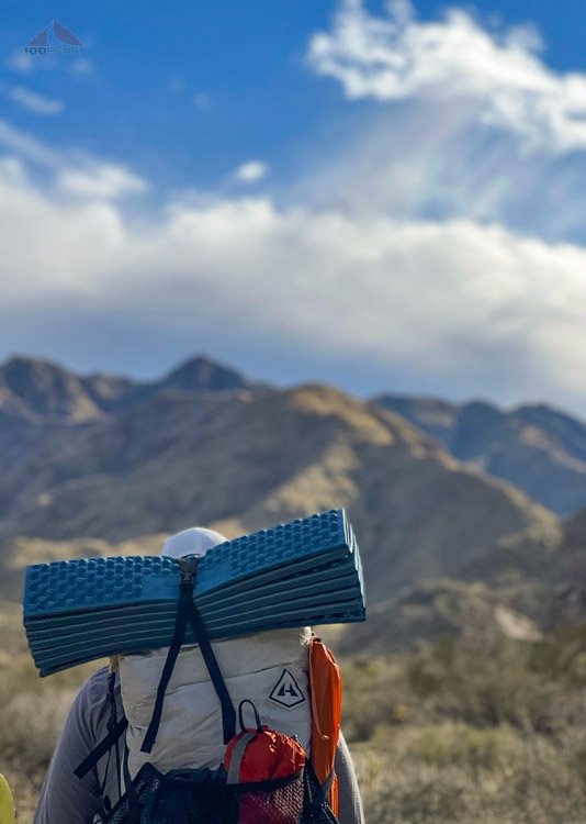
Tip on the trail in the desert
We headed out from San Diego, enjoying the drive through Ramona and Santa Ysabel. We made the route through Ranchita, picking up some supplies at the Montezuma Valley Market (Ranchita Bodega).
We dropped into the desert for some lunch and headed out to see the view from Font’s Point before we drove to the trailhead.

Borrego Badlands from Font's Point
We drove up Coyote Canyon Road, noticing some green in the desert and some purple and yellow flowers. It wasn’t a superbloom, but enchanting nonetheless.
We easily crossed the first crossing of Coyote Creek in my RAV4 and then encountered the deeper Second Crossing. We pulled over a scoped it out. If we stayed to the left, we could make it. And we did.
We continued up the road and easily crossed the second crossing. By now, I was confident that we would make it all the way to the Cougar Canyon Trailhead near Sheep Canyon.
That is, until we approached the initial climb over Boulder Alley. It looks like the heavy rains over the past few months were not kind to the road and the rocks were much more pronounced than they were 10 months prior. We decided to pull over and hike the rest of the way.

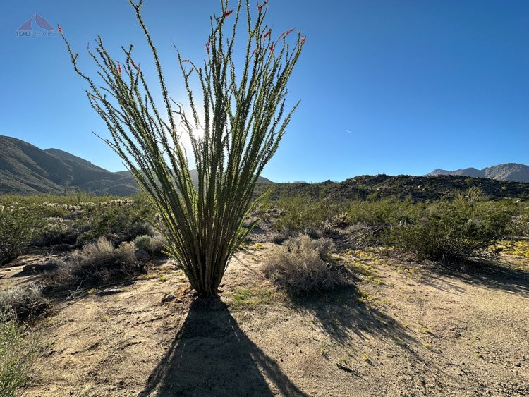
Green ocotillo along the way
We made our way over the bypass road (Boulder Alley) and crossed the desert on the Sheep Canyon Trail. It was nice to be among the blooming flowers, but the soft sand was a bit tiresome with a full pack on.
The desert was green
We were amazed at how green the desert was, with little yellow flowers blooming everywhere. I had initially worried that there was no water in Cougar Creek, but after the depth of the Second Crossing of Coyote Creek and the green desert, I was sure we would fall asleep that night to the sounds of a gurgling Cougar Creek.

The yellow flowers on the desert floor
However, after we turned left at Sheep Canyon and approached Cougar Canyon, we were disappointed to find a bone-dry Cougar Creek.
I had been sure we would find water, since all descriptions I encountered of this hike indicated that water flowed year-round in Sheep and Cougar Canyons.
I was wrong.
Luckily, we brought enough water, though we did have to ration a bit. I grilled hot dogs on my skillet and we each had a beer while watching the full moon rise over the ridge to our east. We really didn’t need our headlamps.

Our campsite
Even though there wasn’t any water, it was an enjoyable third trip to Cougar Canyon. I was able to camp in a slightly different site. It didn’t get too warm and we slept soundly.
The next morning, we enjoyed a cool lazy breakfast while a few jets flew over. After exploring the canyon a bit, we headed back on the trail, staying on the road this time.
It was another successful adventure on the trail to Cougar Canyon.
Panoramic view from the mouth of Cougar Canyon (Click to enlarge)